
by VERACITY ESTIMATING
Fast & Accurate Takeoffs – Powered by AGTEK
Accurate sitework estimating services for developers and site contractors across North America. We cover earthwork (stripping, excavation, cut/fill, grading, backfilling), underground utilities, erosion control, demolition, pavements, concrete flatwork, retaining walls, sidewalk, fencing, gates and landscaping.
Detailed takeoffs for all site and foundation excavation, including bulk and linear cut/fill, trenching, shoring and lagging for trench safety, backfill and compaction.
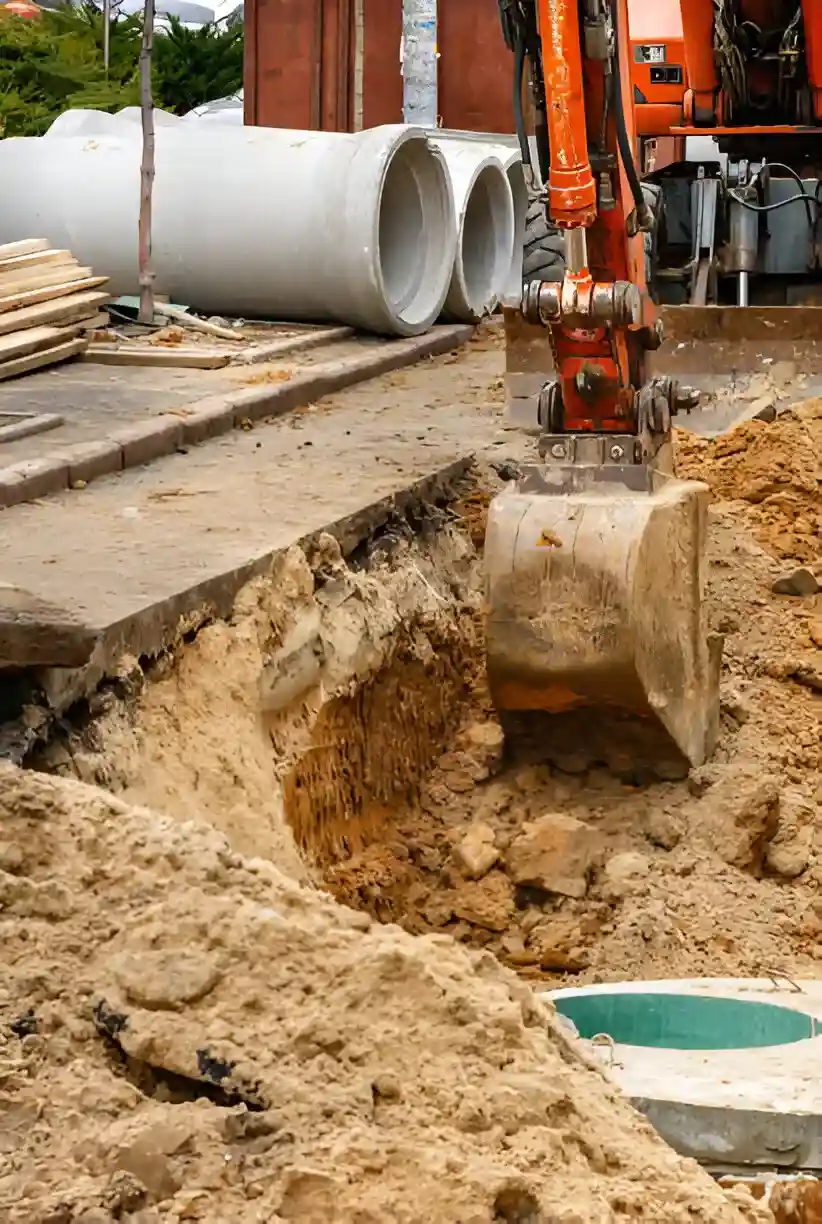
Takeoffs for all underground utility systems, including water, sanitary sewer, storm drain, gas, electrical, and telecom lines. Covers installation, pipes, fittings, manholes, vaults and connections.
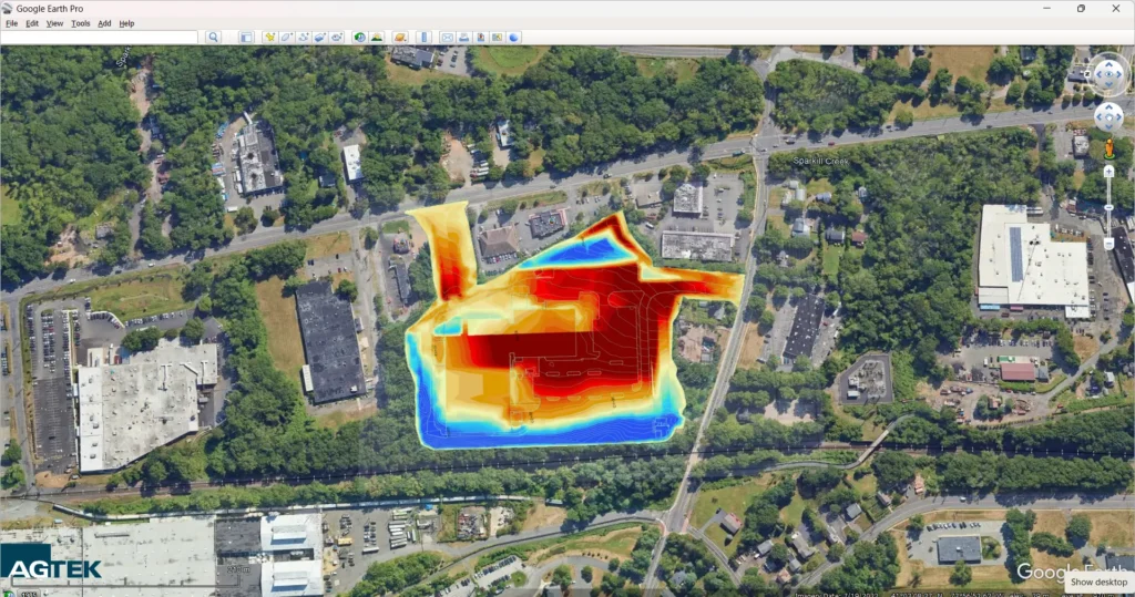
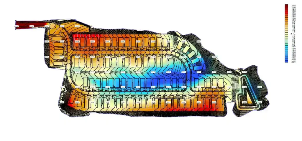
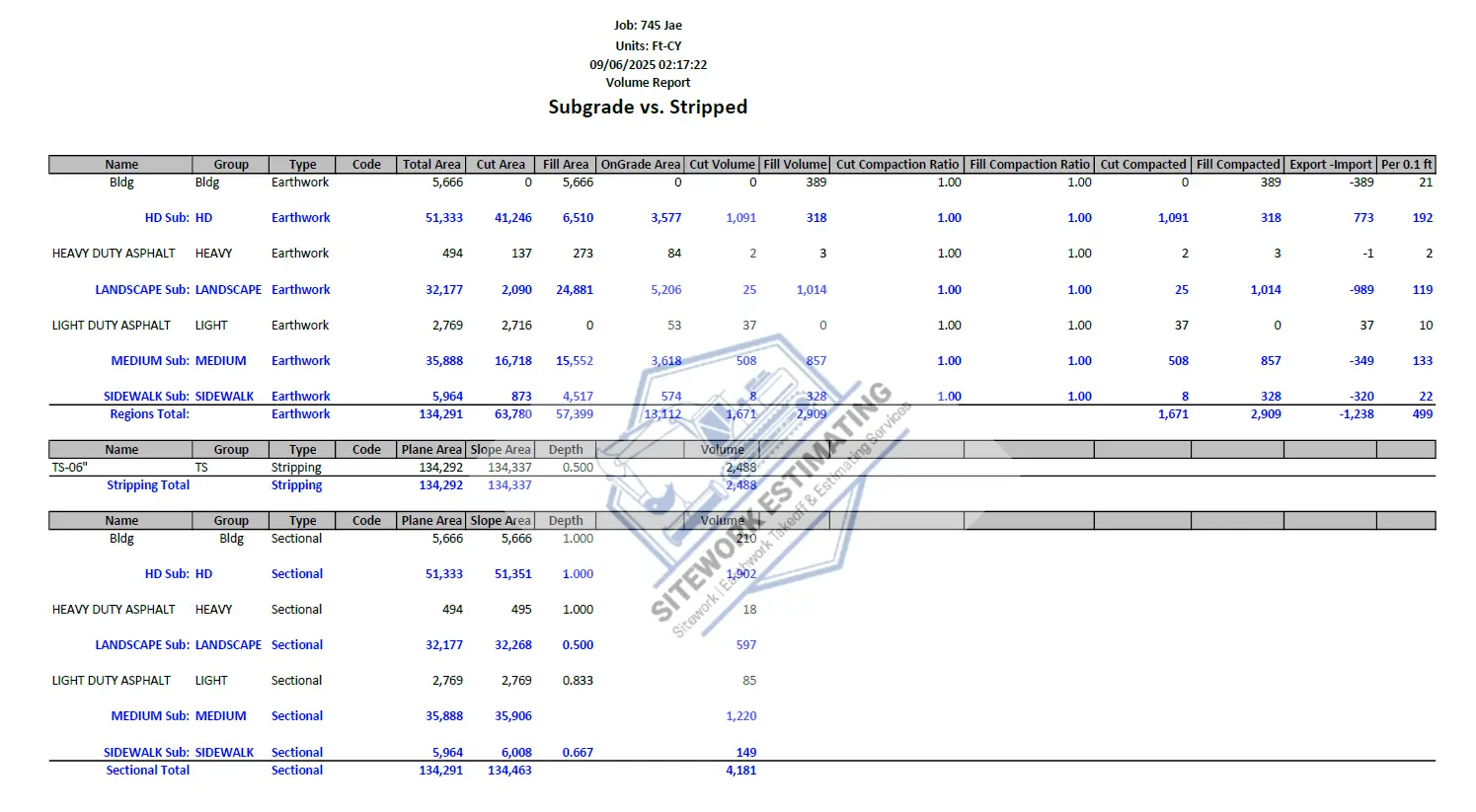
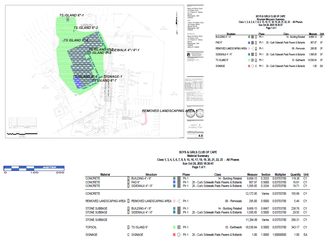
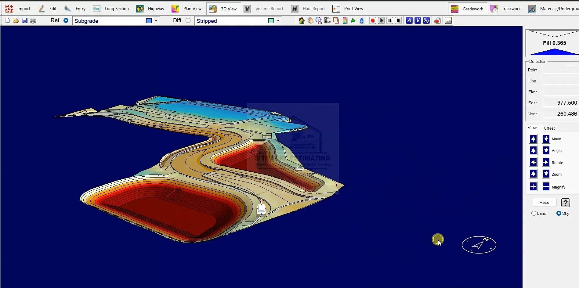
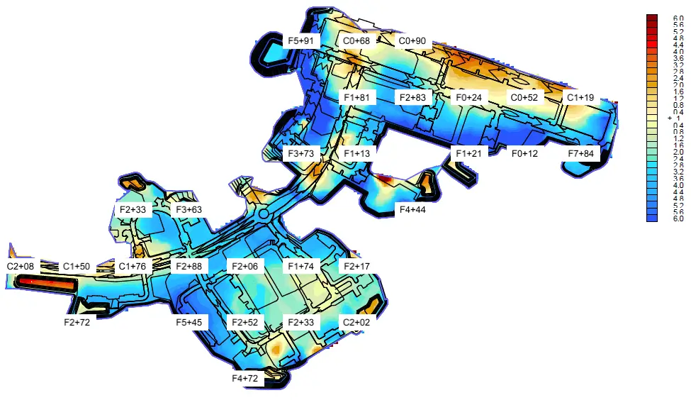
Our earthwork takeoffs cover all dirt work, including topsoil removal, rough grading, and detailed earthmoving, with 3D model of site and import/export calculations for site preparation.
Pavement takeoff include asphalt and concrete areas for roads, parking lots, and driveways, with detailed quantities for base and sub-base materials, paving thicknesses, milling, striping and joints.
Our concrete flatwork estimate include sidewalks, curbs, gutters, aprons, and exterior slabs within sitework projects, with detailed quantities for thicknesses, reinforcement and subgrade preparation.
Accurate takeoffs for all types of retaining walls (gravity, cantilever, sheet pile) and related items such as reinforcement, drainage layers, geogrid, backfill, and foundation preparation.
Demolition and clearing takeoffs include land clearing, grubbing, pavement and concrete removal, structure and foundation demolition.
We quantify silt fence, inlet protection, construction entrances, sediment basins, check dams, turbidity barriers, riprap, seeding, mulching, and erosion control blankets, covering all temporary and permanent measures.
Covers takeoff for patios, fencing, dumpster enclosure, site lighting bases, bollards, signage, stairs, ramps, planter boxes, and landscaping grading.
Empowering contractors and land developers across the United States and Canada with accurate takeoff data for accurate budgeting, bidding, project planning and execution.
Accurate data – Smarter bids – Better projects
Our sitework takeoff and estimate include details of quantity and materials (earthwork, utilities, paving), itemized cost breakdowns (materials, labor, equipment) and annotated/marked-up PDF plans – all provided in spreadsheet format with at least 97% accuracy guarantee in takeoff (depending on the completeness of the drawings) and 60-days revision support.

With AGTEK, we deliver grading accurate to 0.01 inches and earthwork calculations under 1% error, ensuring reliable takeoffs for every project. We deliver accurate, data-driven estimates that help contractors win more bids and control project costs. Our expertise in earthwork, utilities, paving, and site development ensures precise takeoffs and competitive pricing—backed by real-world project experience and industry-leading software. With fast turnaround times, transparent pricing and detailed reports, we provide the reliable estimates you need to minimize risk and maximize profitability on every job.
Precision in sitework estimating builds the foundation for project success. Our commitment to accurate, data-driven estimates empowers contractors to bid with confidence and win more work—because every cubic yard, linear foot, and square foot counts.
In our sitework estimates, we precisely quantify all critical elements including excavation, earthwork (cut/fill volumes, hauling), utilities (pipe lengths, structures), paving (materials, thicknesses), retaining walls (concrete, reinforcement), landscaping (plants, irrigation), demolition (debris, salvage), and fencing (linear footage, components). Every estimate includes detailed material quantities, labor hours, and equipment needs to ensure accurate bidding and cost control for your projects.
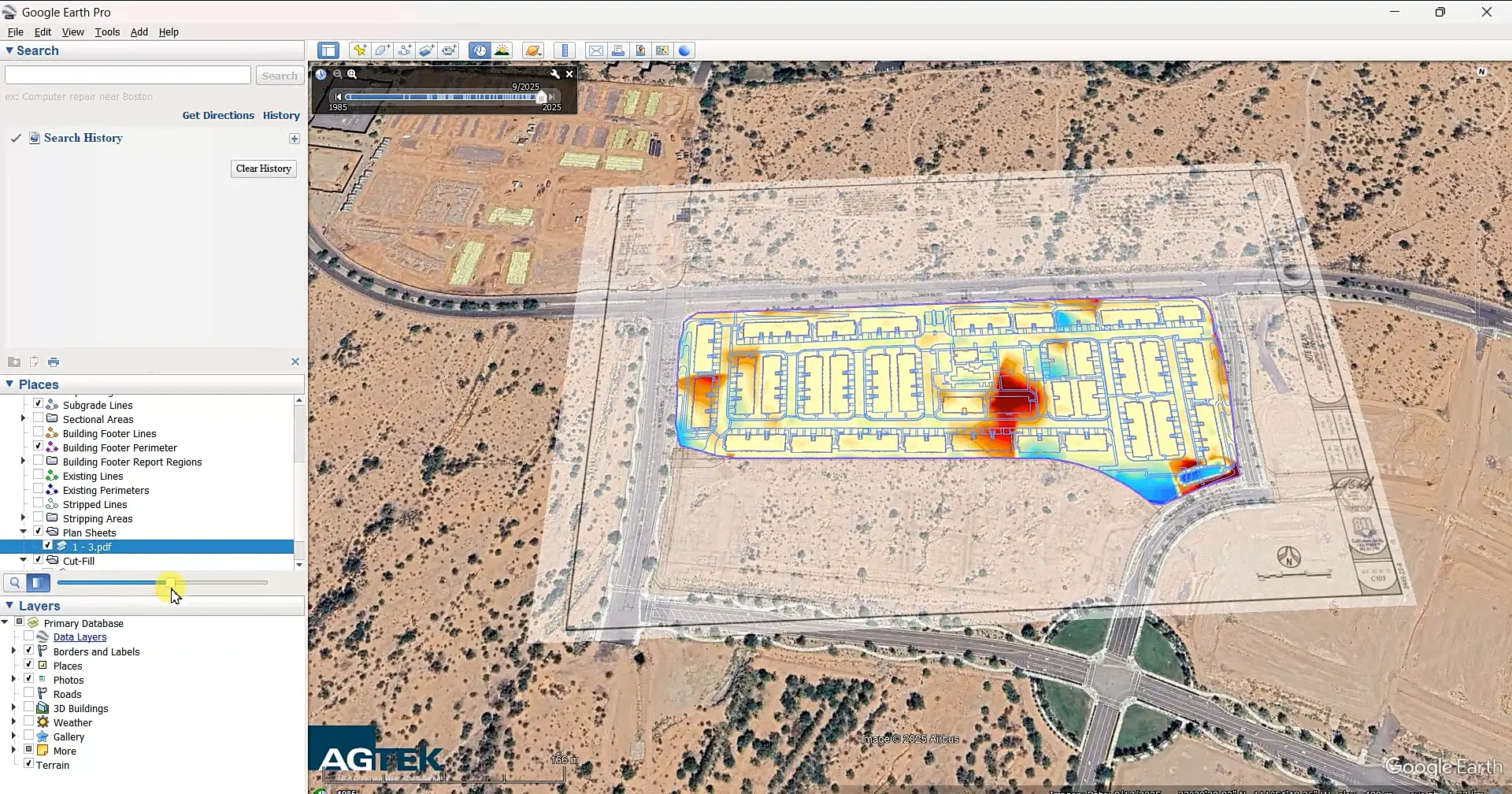
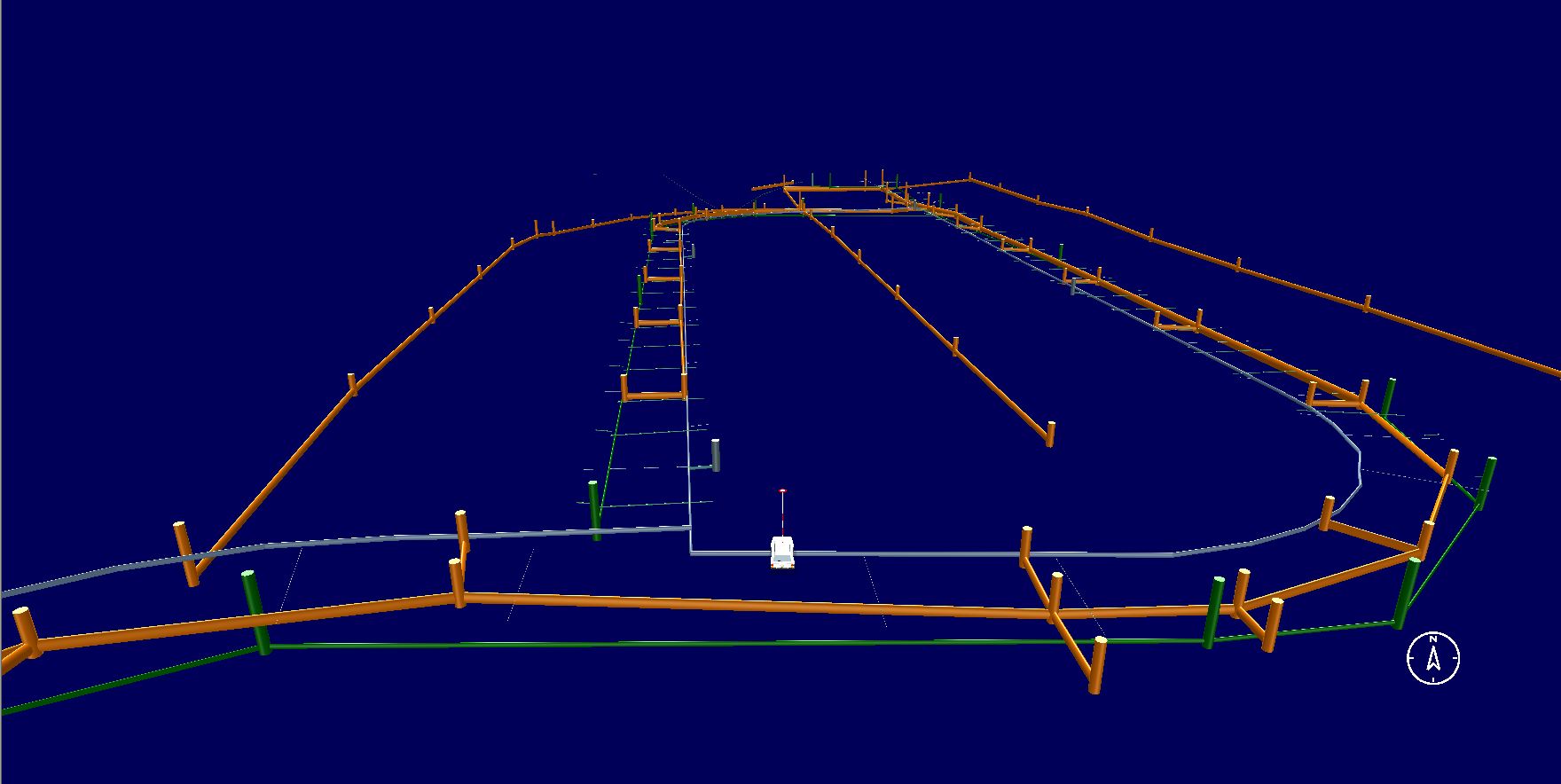
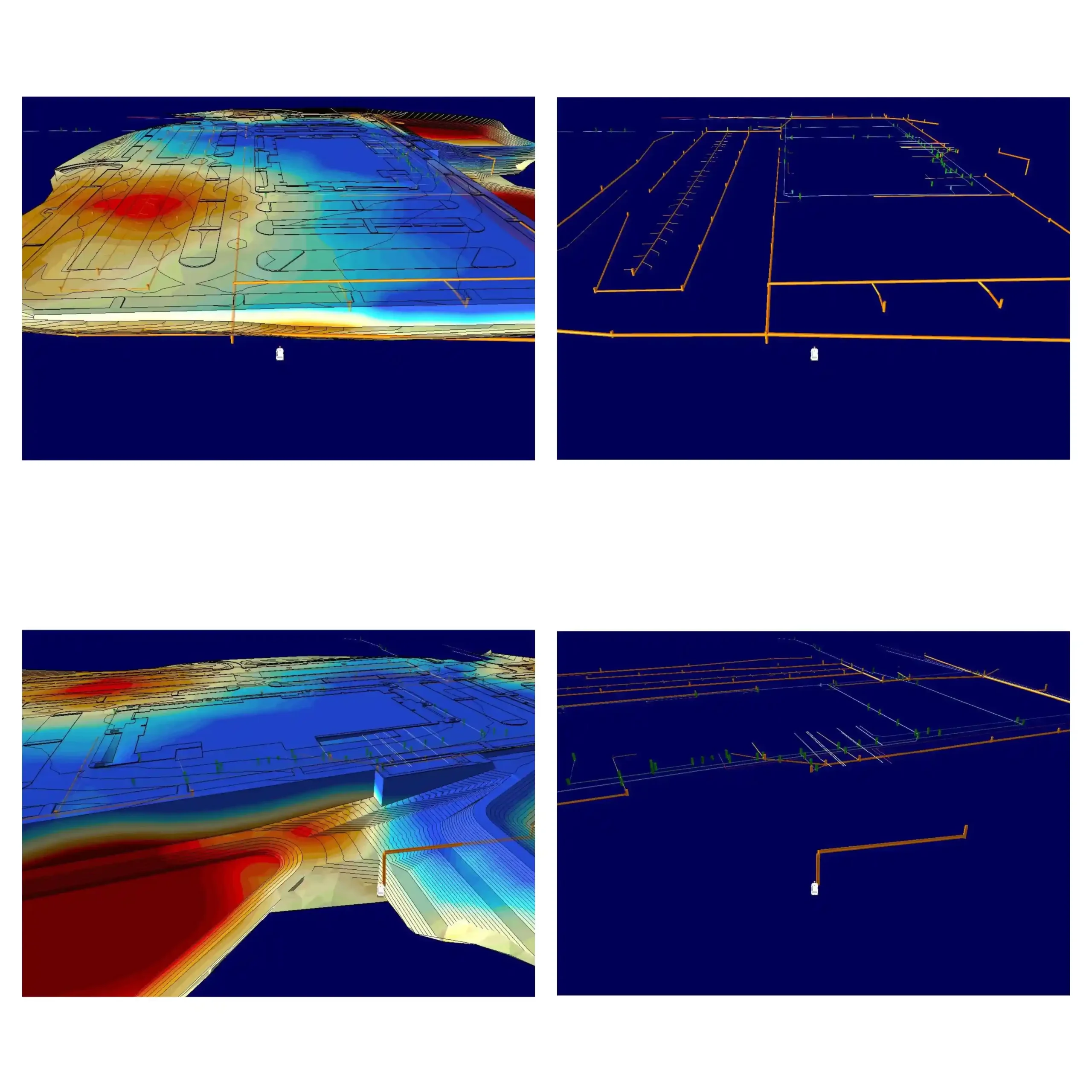
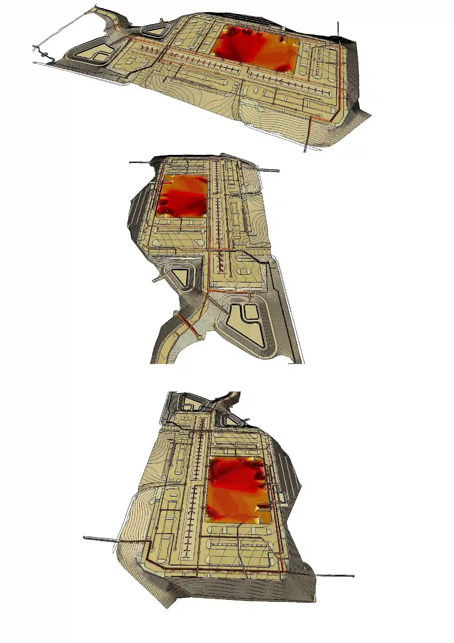
We transform 2D civil plans into precise 3D models, delivering accurate earthwork quantity reports that help contractors competitively bid sitework projects.
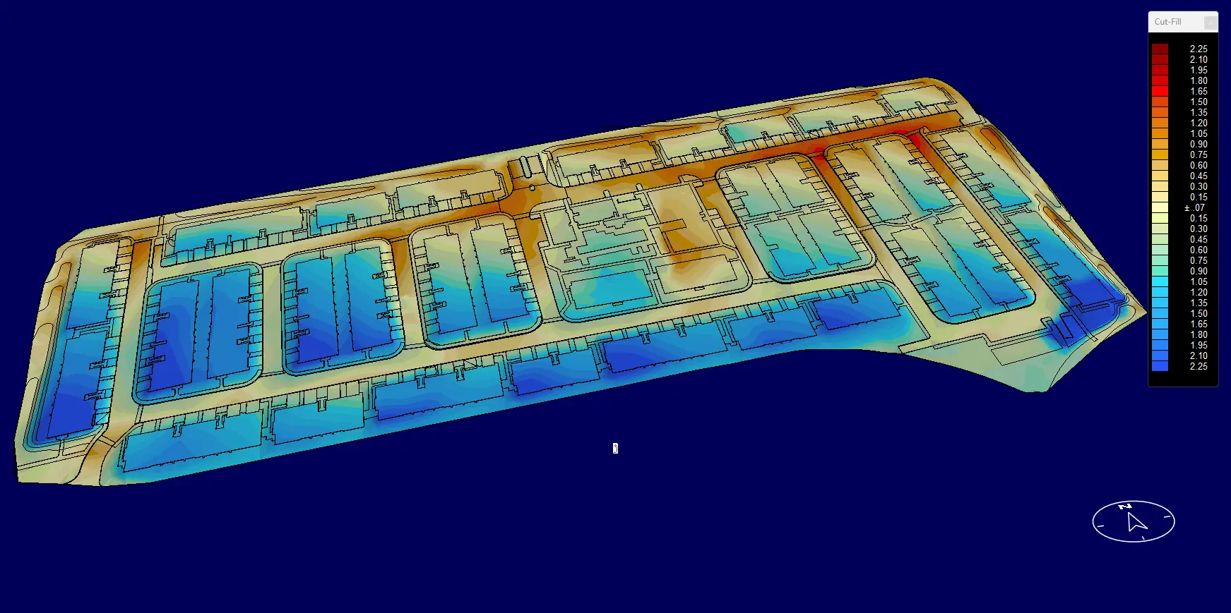
We utilize AGTEK for precise 3D grading modeling, including grading, excavation, and cut/fill analysis for accurate earthwork takeoffs.
With Bluebeam, we can efficiently perform precise earthwork takeoffs by measuring cut/fill volumes, calculating material quantities and marking up plans directly on PDF.
Sitework estimating is the process of calculating all costs for outdoor construction projects, including earthwork (excavation, grading, and fill dirt), utilities (storm drains and water/sewer lines), paving (roads and parking lots), and landscaping (soil, plants, and irrigation). We provide detailed measurements of materials, labor, and equipment needed so contractors can prepare accurate bids and budgets before starting a project.
Outsourcing your sitework estimating delivers significant cost savings, competitive advantages, and risk reduction. By leveraging our expertise, you gain access to specialized software, industry benchmarks, and faster turnaround times without the overhead of in-house staff. Our accurate estimates (with a ±5% accuracy guarantee) help you bid more competitively, avoid costly errors, and scale operations efficiently—turning estimating from an expense into a strategic advantage for winning more profitable projects.
The key difference lies in scope: Earthwork takeoff focuses exclusively on ground movement—calculating cut/fill volumes, hauling, and grading—while sitework takeoff encompasses all outdoor construction elements including earthwork, utilities, paving, landscaping, and structures. Earthwork is the foundation; sitework is the complete package. For example, a warehouse project needs earthwork takeoff to balance dirt (50,000 CY) and sitework takeoff to price utilities, paving, and fencing—both are essential for accurate budgeting.
Accurate estimates help contractors win more bids by providing competitive pricing, avoid financial losses by preventing unexpected costs (such as soil issues or material shortages), and plan more effectively by ensuring the right resources are allocated. Even small errors can lead to significant losses—for example, a 10% mistake on a $1 million project could cost $100,000. Our precise estimates give contractors the confidence to bid competitively while protecting profit margins.
A 3D takeoff uses digital terrain modeling (DTM) software to create a three-dimensional model of the existing and proposed site surfaces. The software then calculates precise cut and fill volumes directly from the model.
Pros: Higher accuracy, better visualization, faster for large/complex sites, integrates well with machine control and GPS grading equipment.
Cons: Slightly higher cost, requires good-quality CAD files (DWG, DXF, or LandXML).
Yes, typically 3D takeoff costs a bit more because it requires specialized software and modeling. However, the investment often pays off by preventing costly errors in the field and providing a clearer understanding of earthwork quantities.
We deliver precise sitework estimating and takeoff services across all 50 states, including high-volume markets like California, Texas, New York, Florida, Pennsylvania, Illinois, Ohio, Georgia, North Carolina, Michigan, New Jersey, Virginia, Washington, Arizona, Massachusetts, Tennessee, Indiana, Missouri, Maryland, Wisconsin.