Accurate underground utility quantities and clear underground clash identification are critical for planning, pricing and risk reduction on civil and site projects. We deliver measurable, bid-ready quantities that help site contractors and utility subcontractors build competitive proposals without exposing the project to avoidable surprises.
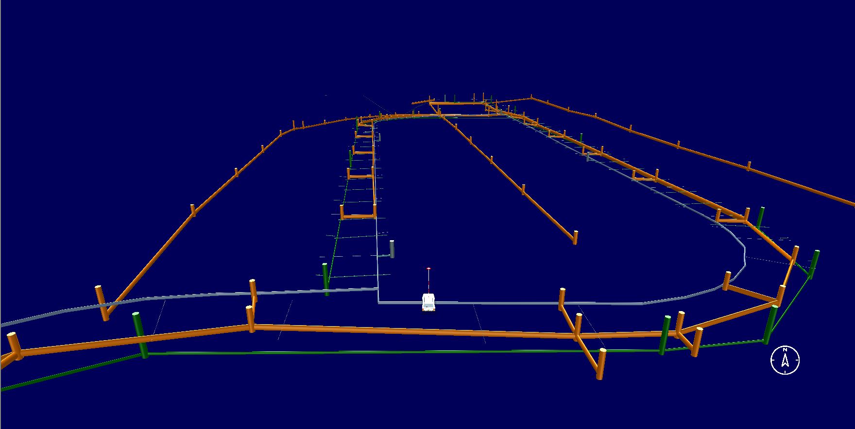
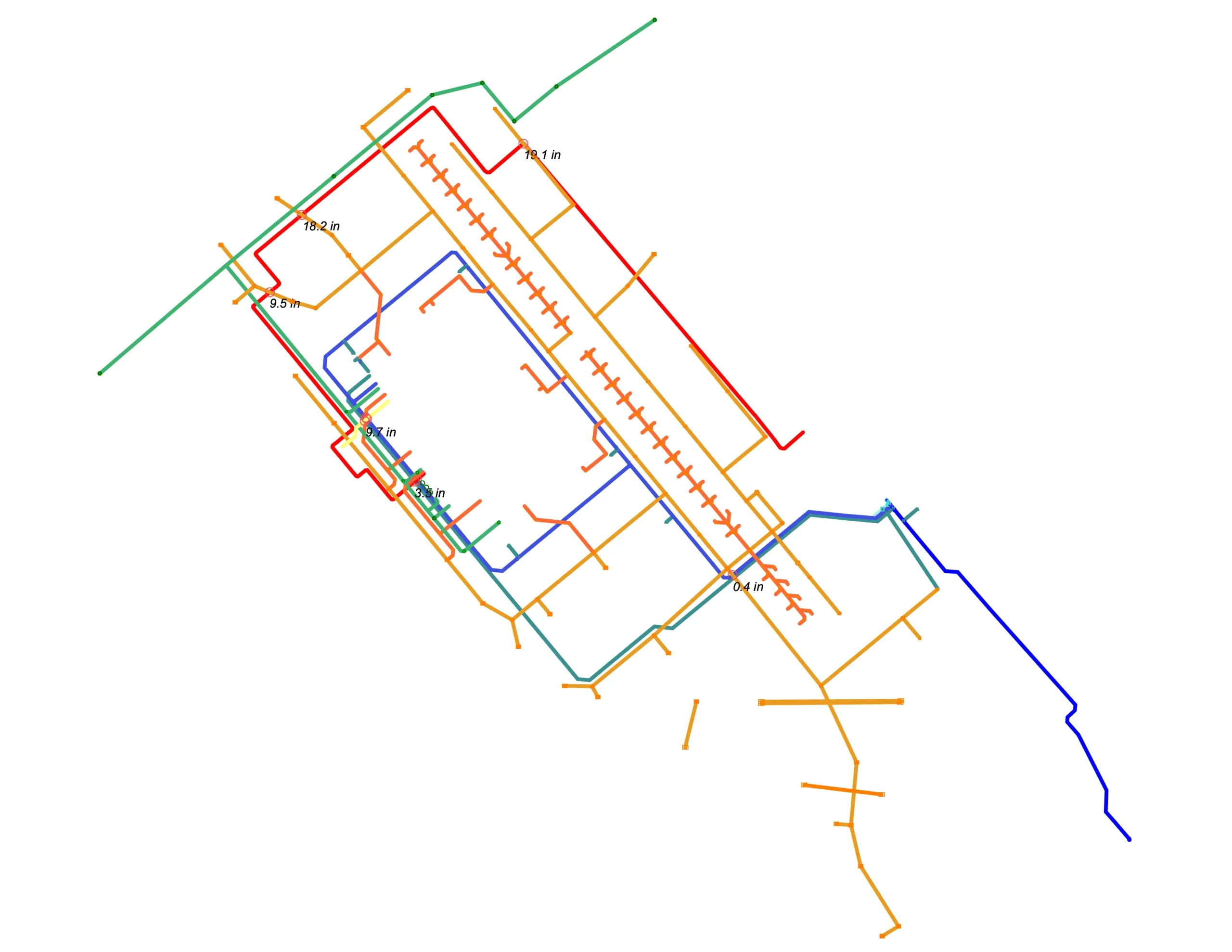
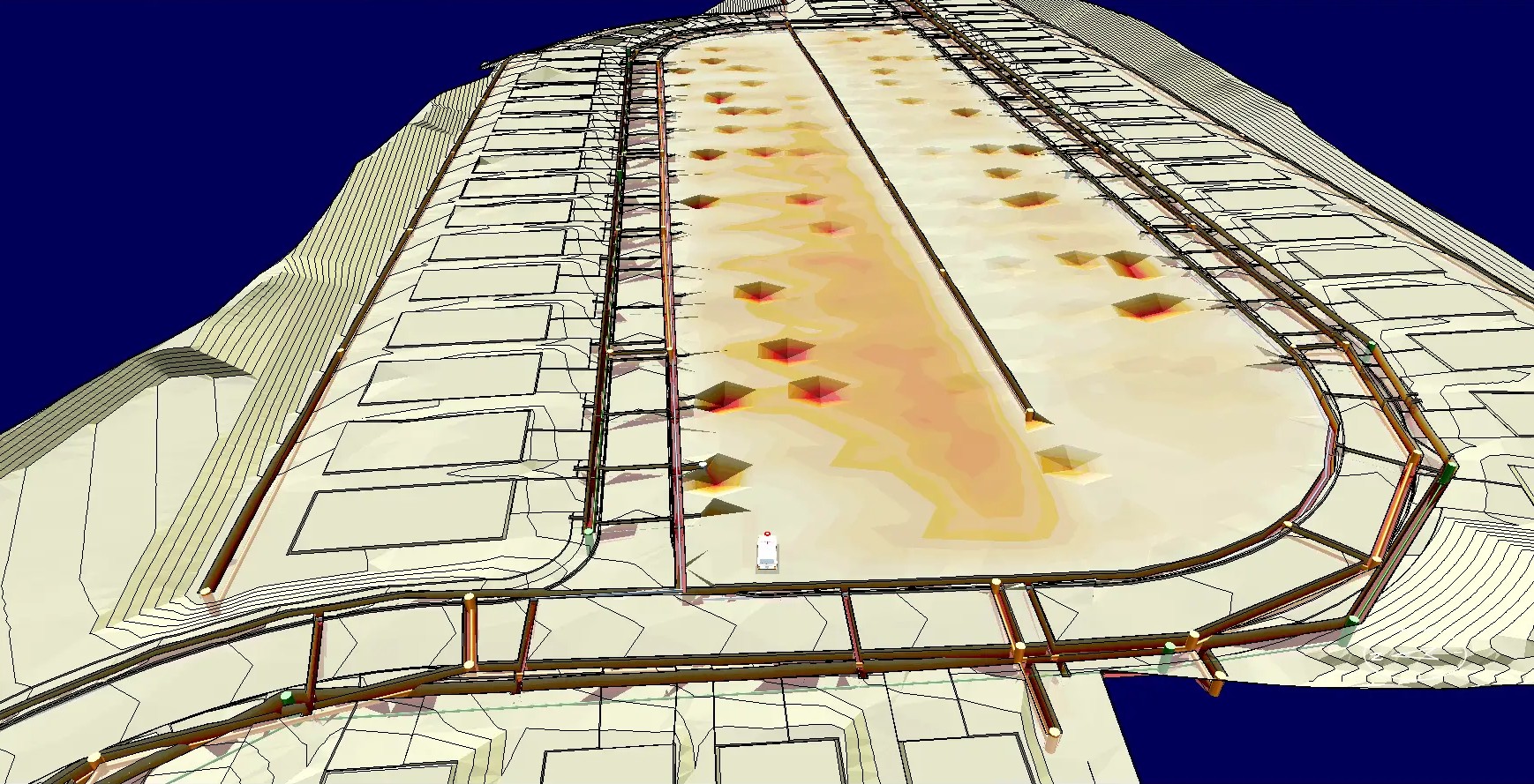
We prepare accurate underground utility takeoffs in AGTEK, extracting quantities directly from plan sets and profiles to support fast, defensible bidding. Deliverables typically include pipe and conduit lengths by size, structure counts (manholes, inlets, vaults, pull boxes), and supporting quantities such as trench runs, bedding/backfill (when details allow), and restoration items as required. The output is organized in an estimator-friendly format aligned to your bid items and scope.
We calculate trench lengths and excavation volumes for underground utilities based on U.S. plan sets, profiles, and standard civil details. This includes trench runs by utility type, excavation quantities, bedding and backfill volumes, and pavement or surface restoration areas where shown. All quantities are structured to align with U.S. bid schedules and construction methods so contractors can price labor, equipment, and materials with confidence.
We review proposed and existing utility layouts to identify conflicts that can drive schedule delays and change orders, including crossings, tight corridors, potential clearance issues, and clashes with structures, grading, or tie-ins. Using the plan information available (and profiles/elevations where provided), we document conflict locations so your team can price risk correctly, issue RFIs early, and reduce rework before construction starts.
We produce detailed underground utility takeoffs using AGTEK, ensuring consistent measurement methods, repeatable reporting, and clean deliverables that align with real construction workflows. Alongside standard quantity extraction, we also provide utility conflict identification to help you detect clashes early and prevent rework, delays, and field change orders.
Depending on your estimating workflow, we provide:
If you need accurate underground utility quantities and early conflict visibility, we can deliver a clean, professional takeoff package built in AGTEK, aligned with your bid items and timeline.

Underground scope is a frequent source of bid risk due to:
Incomplete or outdated utility records
Shallow/unknown existing lines
Congested corridors and limited easements
Tie-in complexity and unforeseen crossings
Restoration scope differences (paving, sidewalk, curb, striping)
A precise AGTEK takeoff combined with conflict identification helps you:
Bid with confidence
Reduce contingency guesswork
Prevent costly change orders
Improve scheduling and crew planning
Strengthen RFI strategy before award
We work with a broad range of public and private clients across the U.S. and Canada, including:
An underground utility takeoff is a detailed quantity report of below-grade utility work shown in the plans—such as storm, sanitary, water, electrical/telecom conduit, and associated structures (manholes, inlets, vaults, pull boxes). Contractors use these quantities to price materials, labor, equipment, and restoration accurately for bidding and planning.
Yes. We perform underground utility takeoffs using AGTEK, which helps maintain consistent digitizing, clean measurement logic, and repeatable reporting. This improves accuracy and makes it easier for estimating teams to review quantities and compare revisions during bid time.
We commonly quantify storm drainage, sanitary sewer, water mains, electrical conduit/duct banks, telecom/fiber conduit, and other utility scopes included in the plan set. If gas or specialty utilities are shown, we can include them as well, provided the drawings contain enough information to measure reliably.
Utility conflict identification is the process of spotting likely clashes—such as crossings, congested corridors, clearance concerns (when profiles/elevations exist), or conflicts with structures and grading. Catching these issues early helps reduce change orders, prevents rework, and supports better RFIs and bid risk planning.
We can identify plan-based conflicts using the documents provided (civil sheets, utility plans, profiles, details, addenda). If SUE levels, as-builts, or surveyed utility data are available, conflict review becomes more reliable. Where information is missing, we flag it as risk rather than making assumptions.
We provide a full range of sitework and civil engineering services to support accurate planning and bidding.