Explore Our Takeoff Samples with 3D Model (Cut/Fill Heat Map) - AGTEK
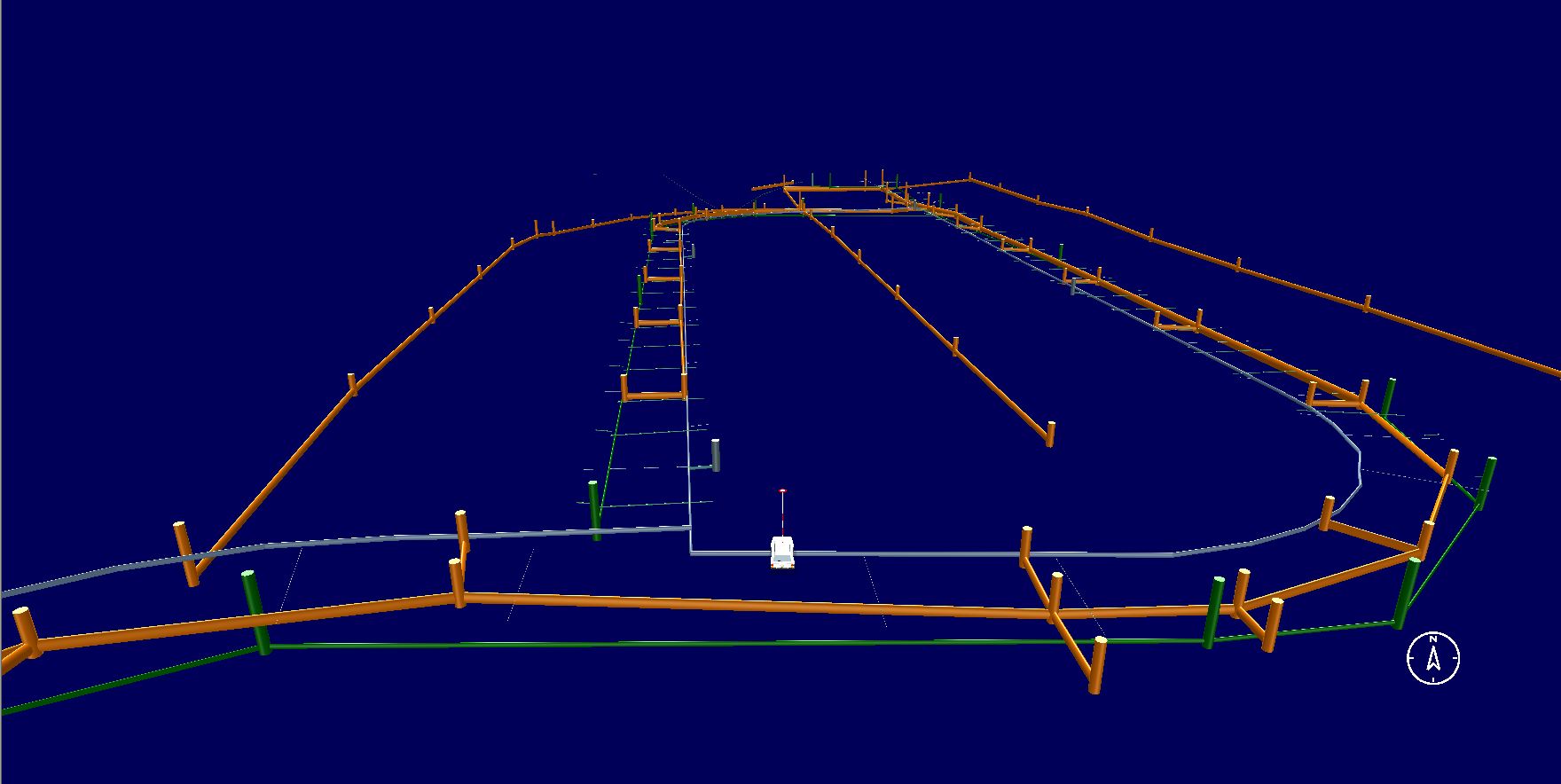
View examples of excavation, earthwork, grading, underground utility, pavement, asphalt, site concrete, and full-scope sitework and civil takeoffs completed by our experienced estimating team.
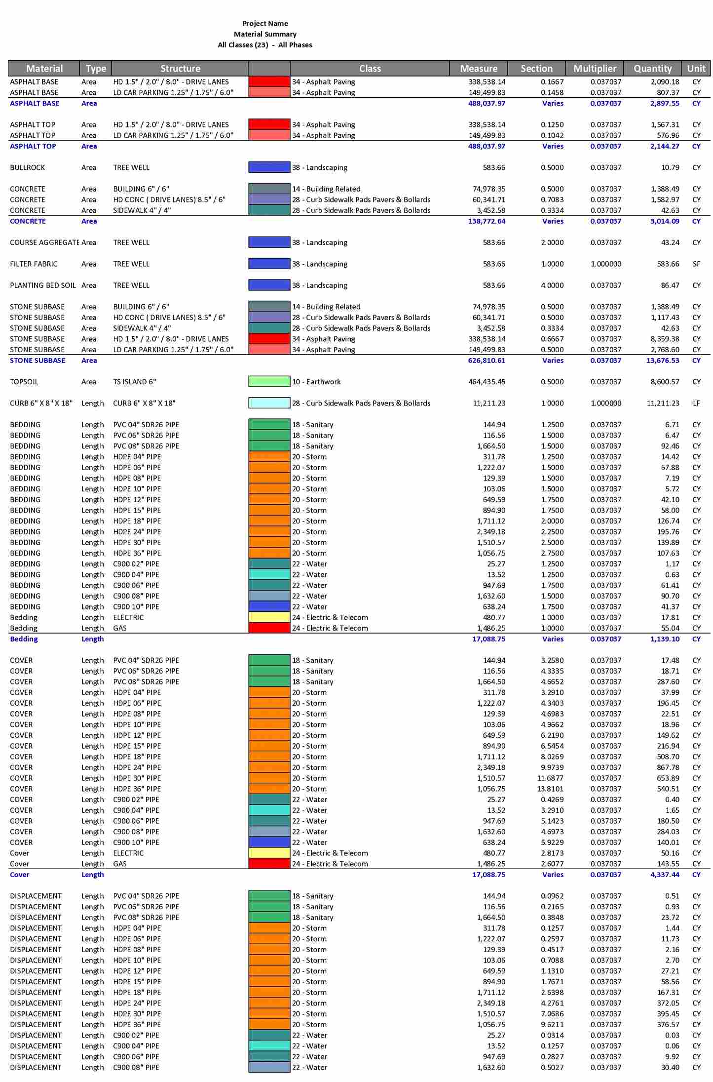
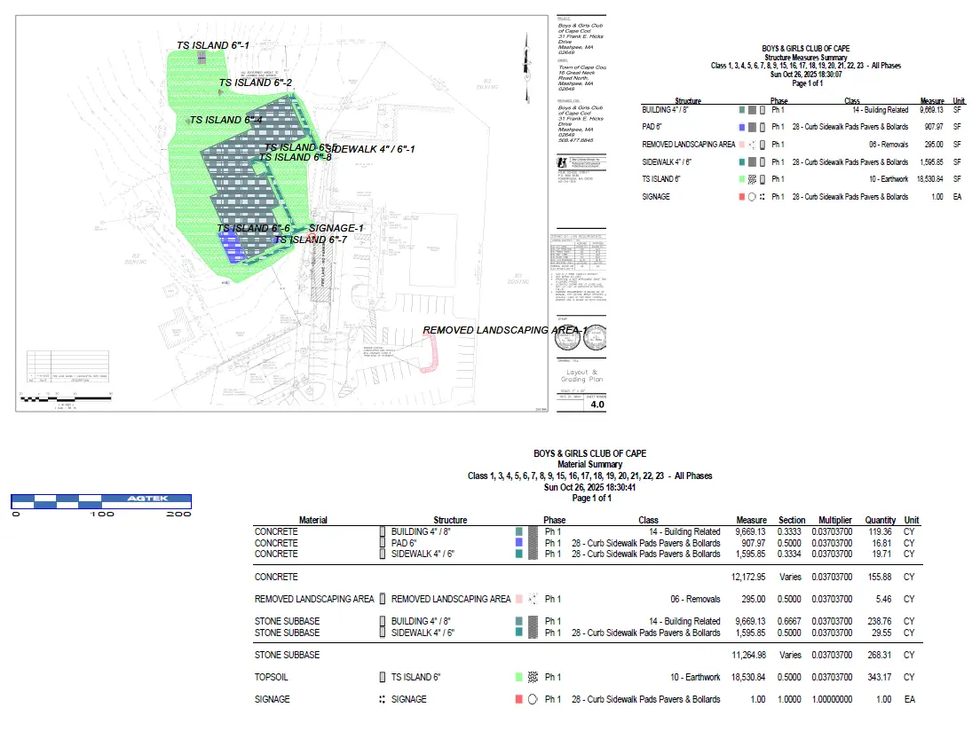
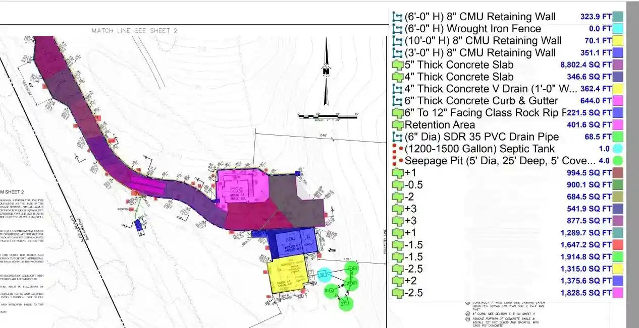
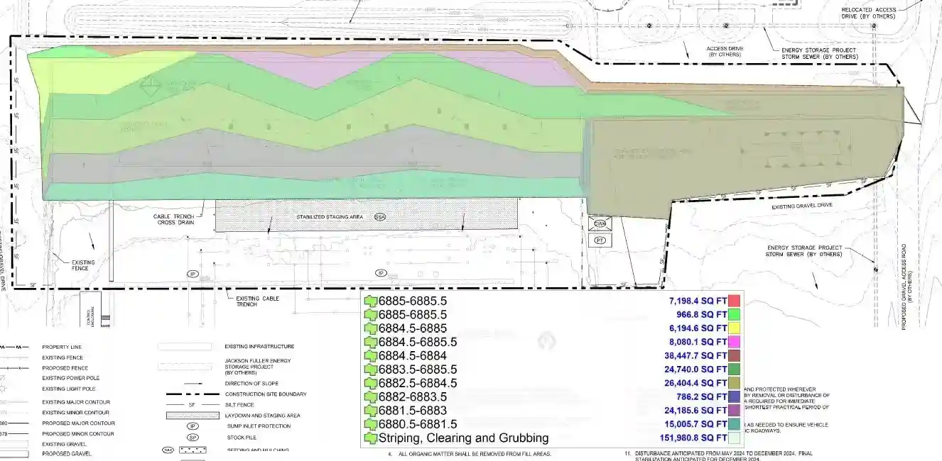
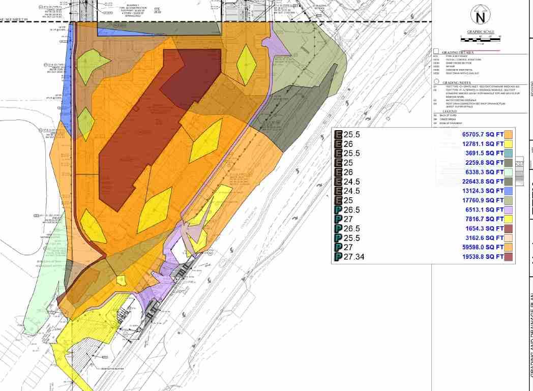
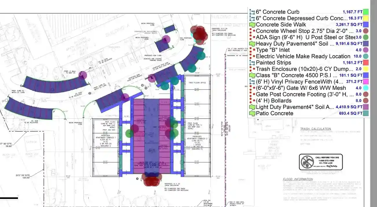
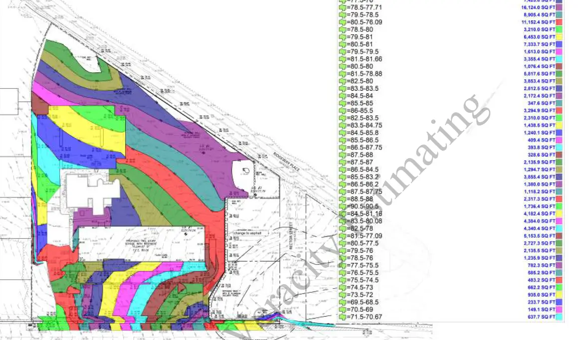
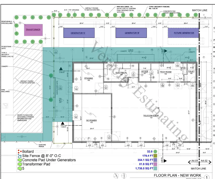
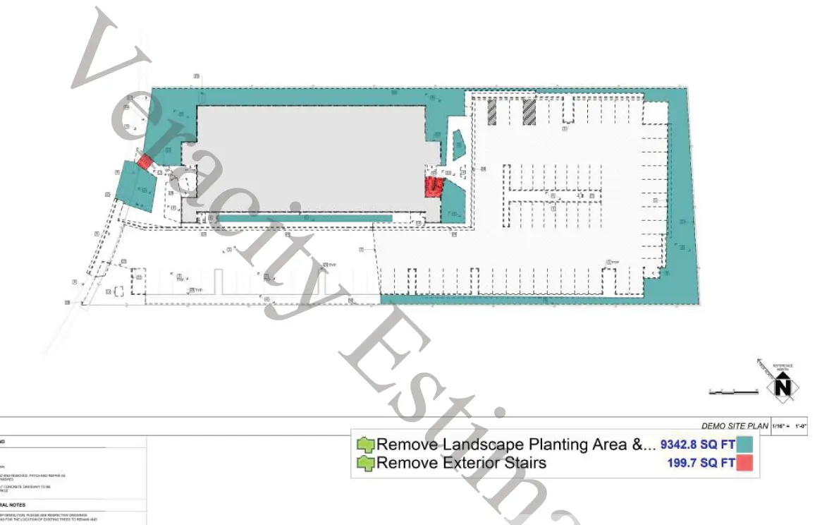
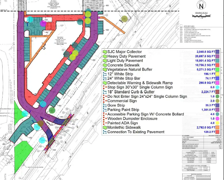
Detailed quantity takeoffs for asphalt paving, concrete pavements, sidewalks, curbs and gutters, driveways, curb ramps, medians, valley gutters, concrete pads, pavement sections, demolition quantities, and associated base and subbase materials.
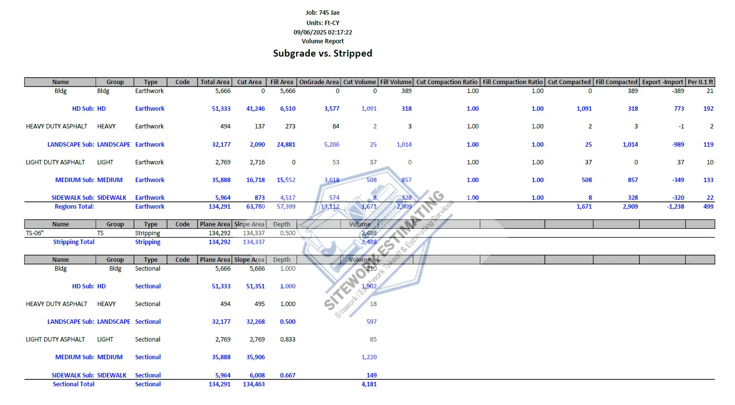
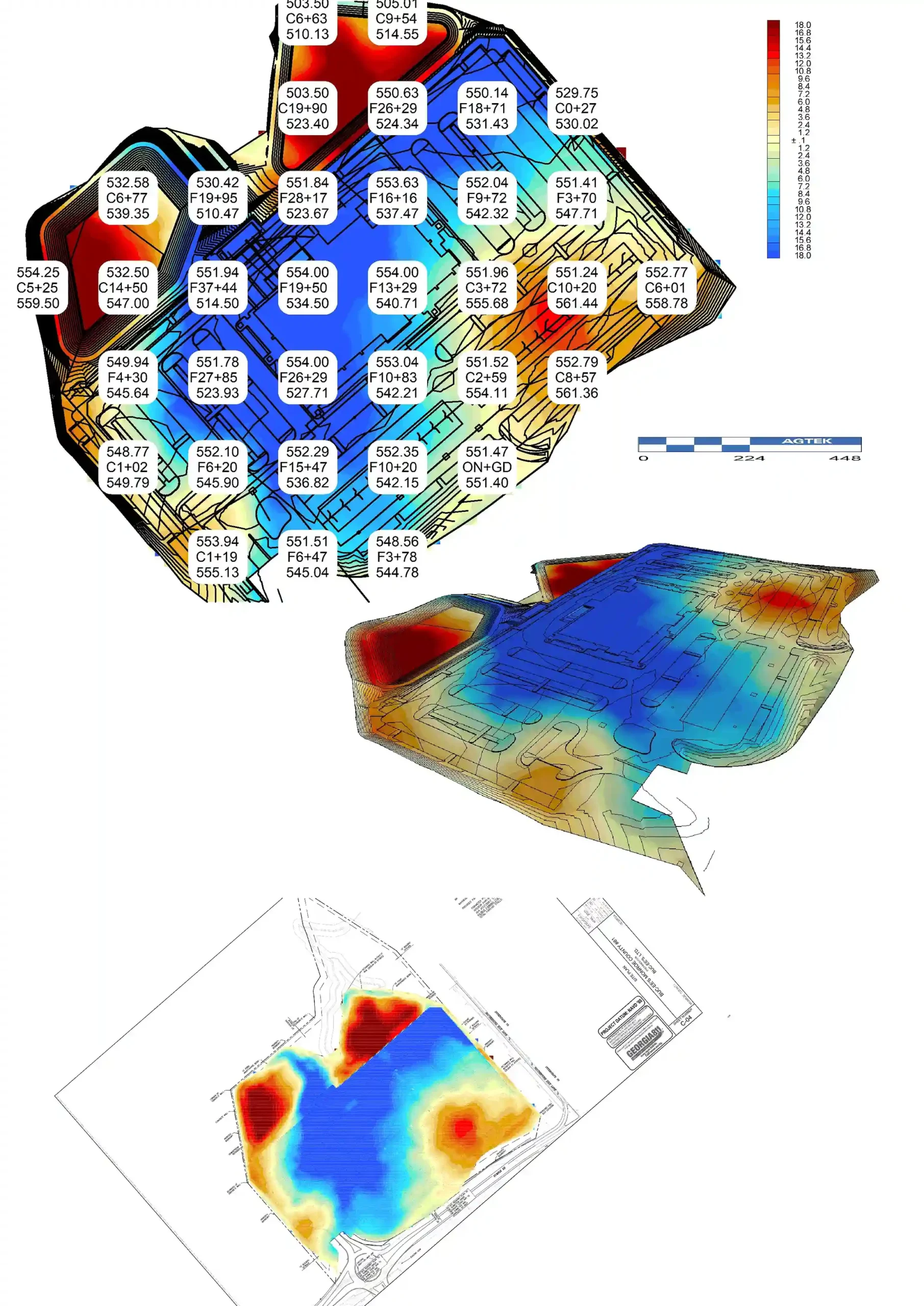
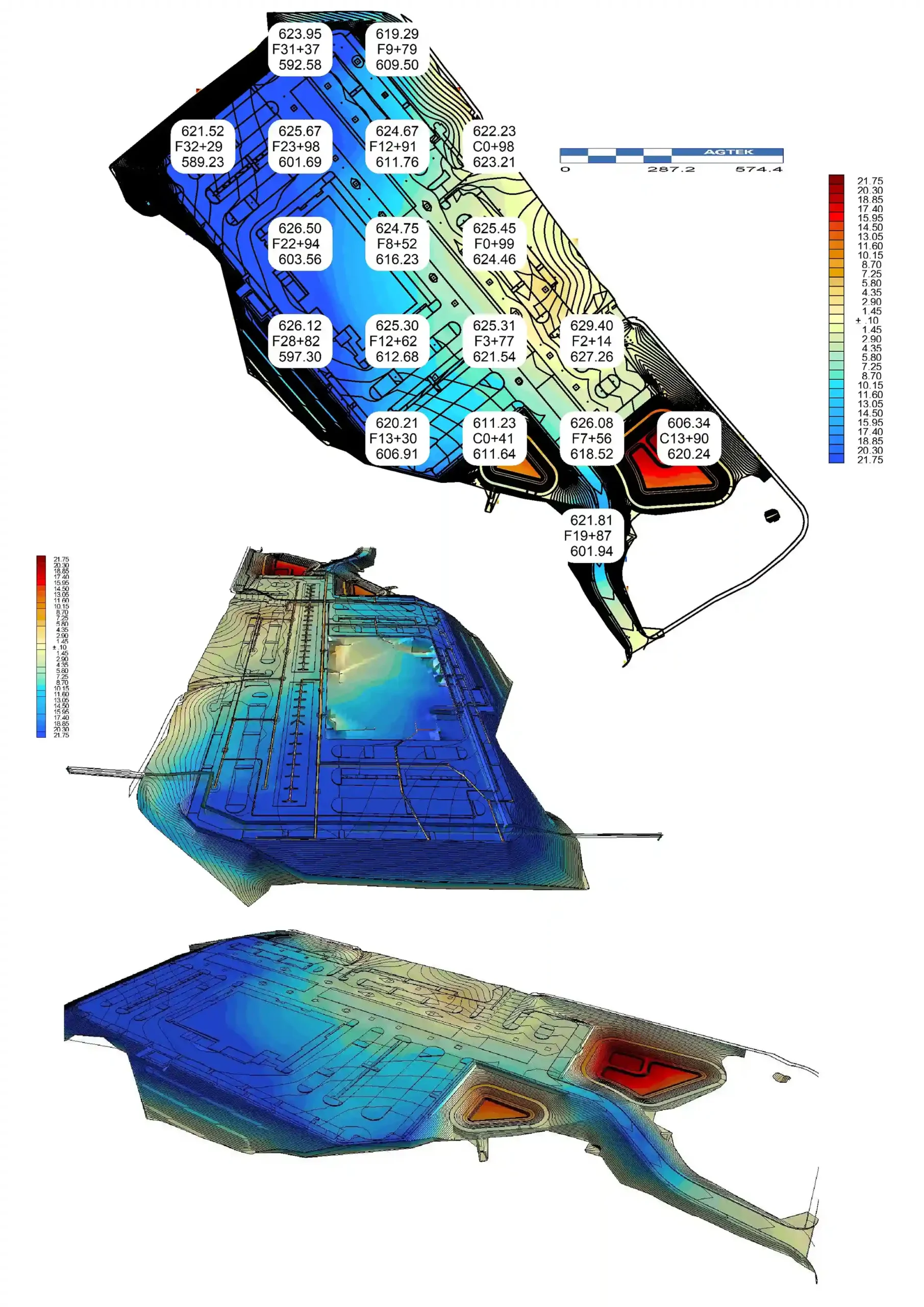
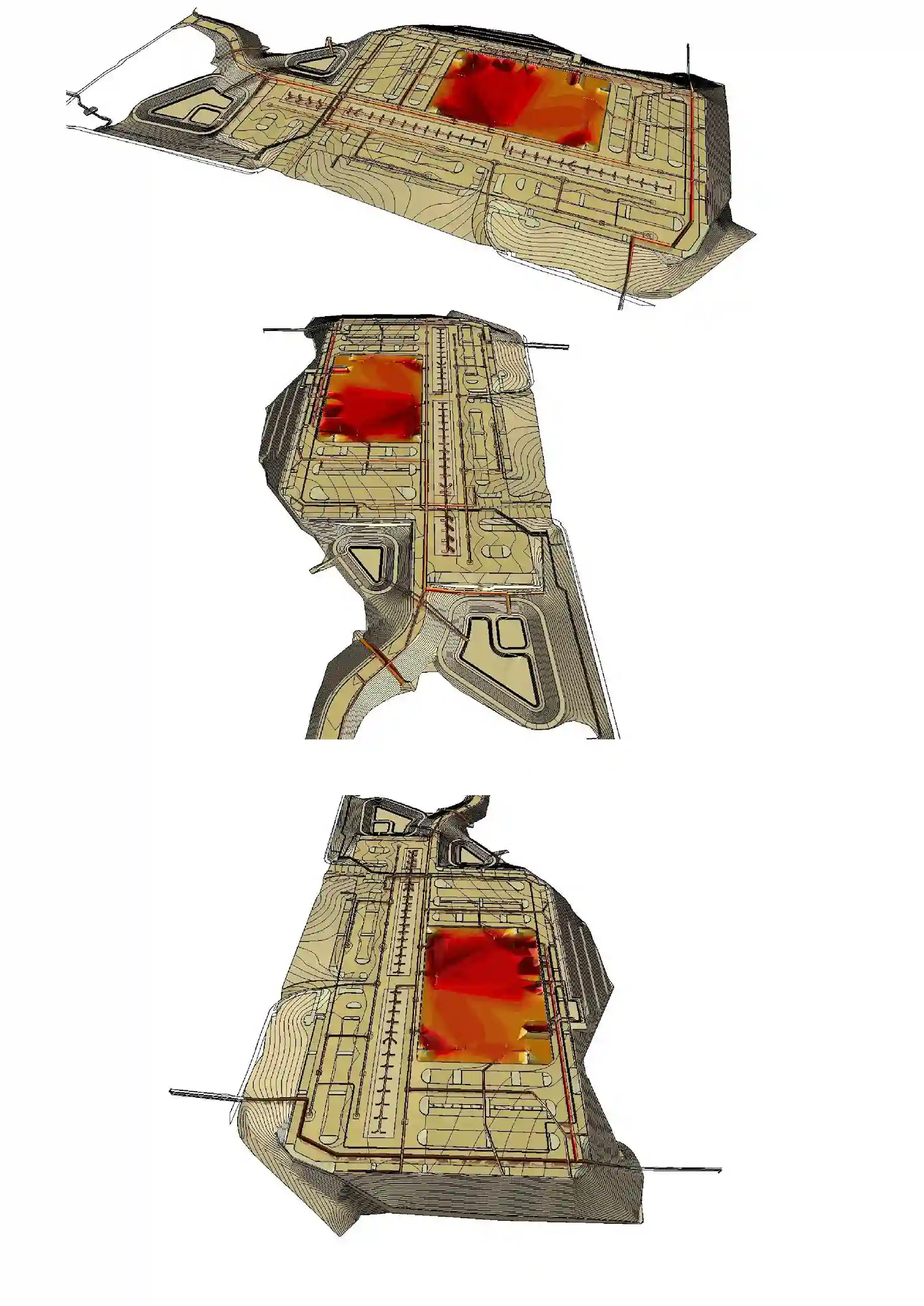
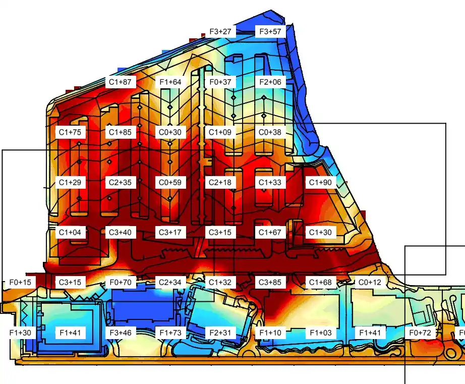
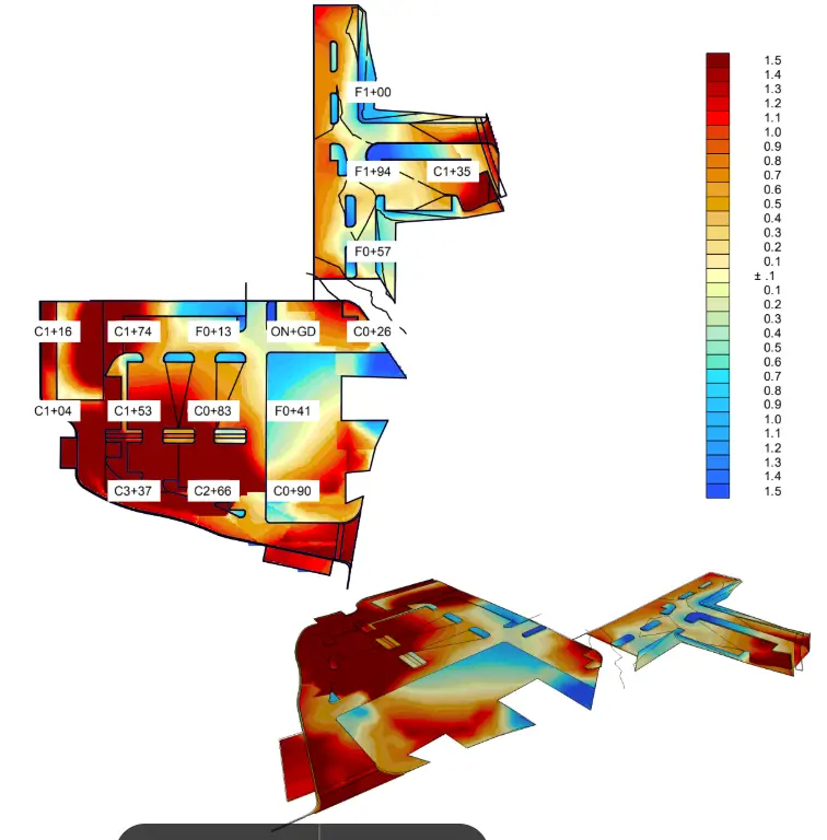
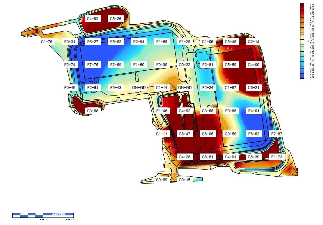
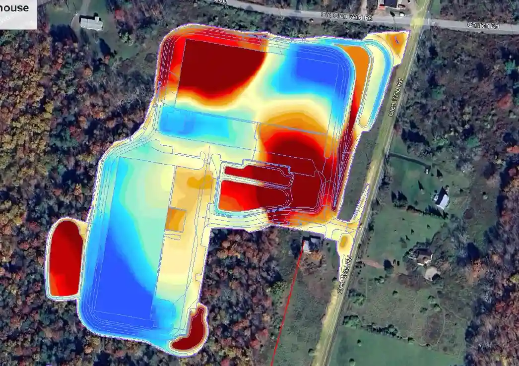
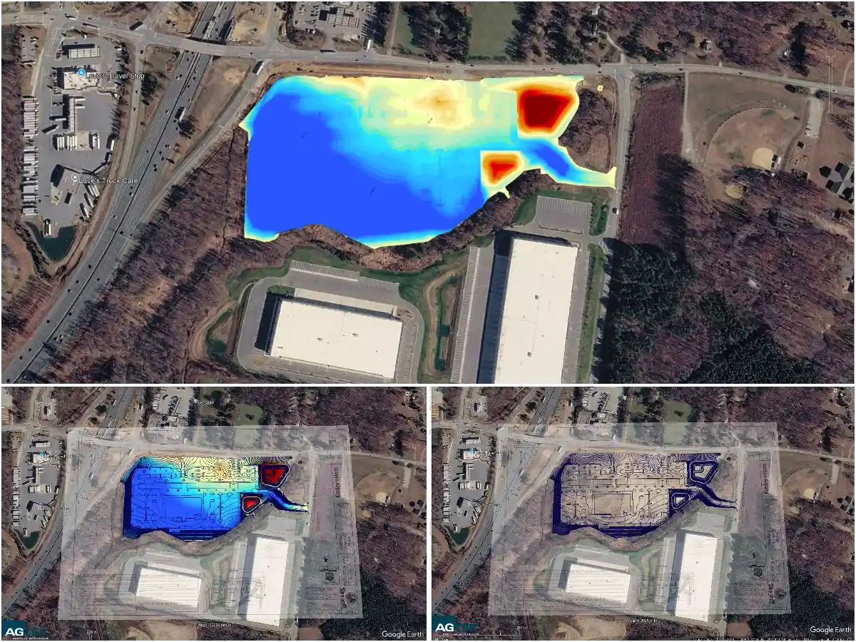
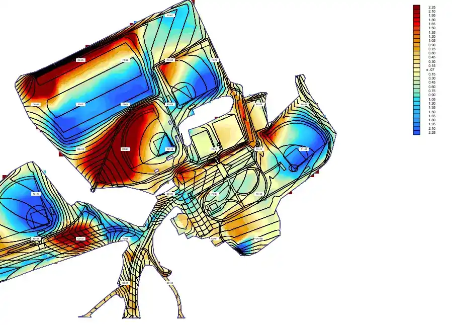
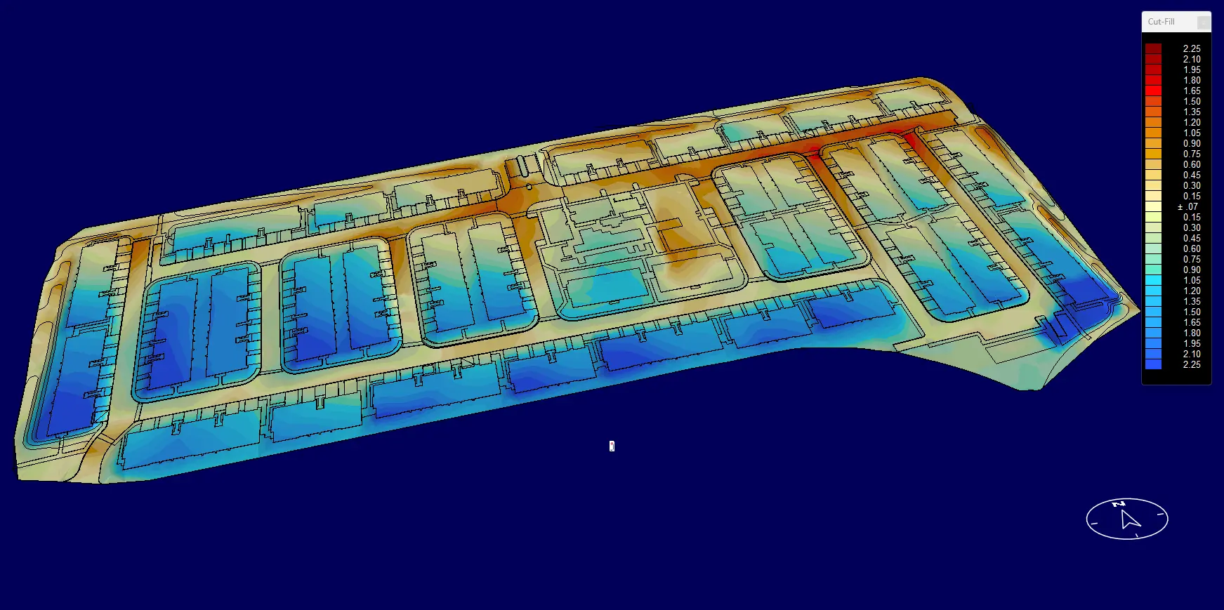
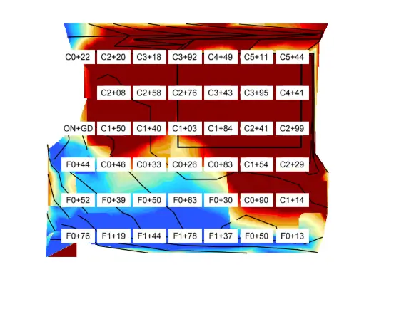
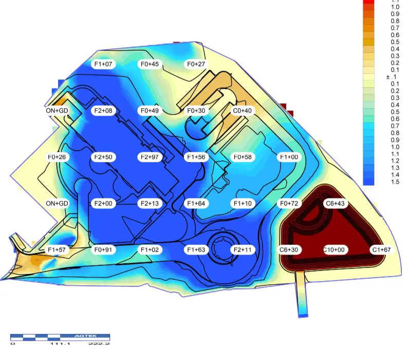
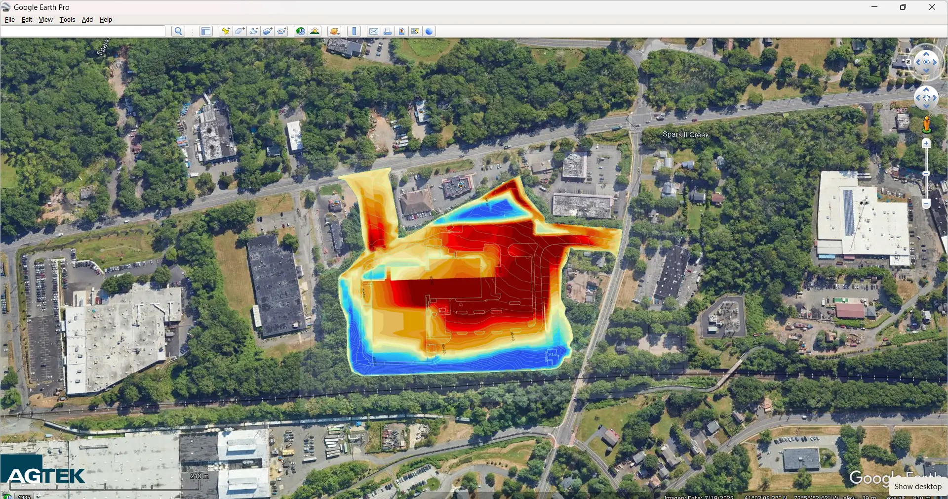
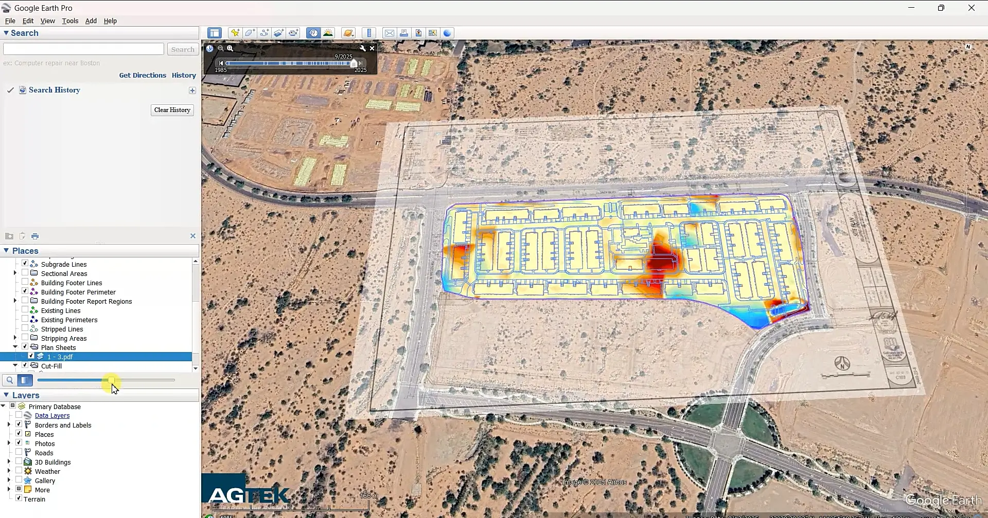
Agtek 3D Earthwork Visualization (Heat Map): Accurate Cut & Fill Analysis
For AGTEK Users Only
⇓⇓ Please note: An active AGTEK subscription is required to view the 3D site model, volume reports, and material takeoff reports in the AGTEK file formats provided below. ⇓⇓