
Our earthwork takeoff services cover every aspect of site preparation and excavation to ensure accurate project planning and cost estimation. We provide mass excavation with cut and fill balancing, delivering precise calculations for efficient grading. Stripping of topsoil and existing pavement is included, with quantities determined for removal and potential reuse. We handle mass excavation for fill and subgrade preparation, ensuring a stable foundation for your project. Our takeoff also include clearing, grubbing, and stump removal.
For more challenging conditions, we perform site and trench rock excavation takeoff based on geotechnical reports, and calculate import borrow requirements to ensure sufficient fill material is available. Excavation to waste is quantified according to project specifications, whether onsite or offsite. We provide foundation excavation takeoffs for footings, slabs, and structural foundations. Additionally, we account for erosion and sediment control measures to protect the site during construction.
Want to know more about our standard deliverables and add-ons?

We obtain all available project information, including:
Civil plans (grading, utilities, profiles, details)
CAD/model files (DWG, DXF, LandXML)
Survey data (contours, spot elevations, breaklines)
Geotechnical reports (soil conditions, recommendations)
If CAD/survey data isn’t available, we digitize from PDFs.
We create a 3D surface of the existing site conditions using survey data, contours, and elevations. A precise existing ground model ensures reliable calculations.
We create a 3D surface of the existing site conditions using survey data, contours, and elevations. A precise existing ground model ensures reliable calculations.
We model over-excavation for building pads or unsuitable soils as needed. Utility trench excavation (storm, sewer, water, etc.) is also staged and reported with backfill volumes.
We model the finished grade (FG) surface for parking lots, drives, sidewalks, and pads. Subgrade depths are applied per pavement and structural requirements for precise volume breakdowns.
Our analysis includes:
Cut, fill, and site balance
Import/export needs
Stripping and unsuitable removal
Utility trench excavation/backfill
Rock excavation (if required)
Shrink/swell and compaction adjustments
You’ll receive:
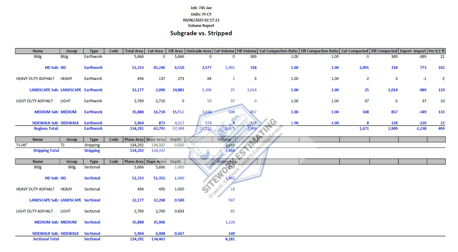
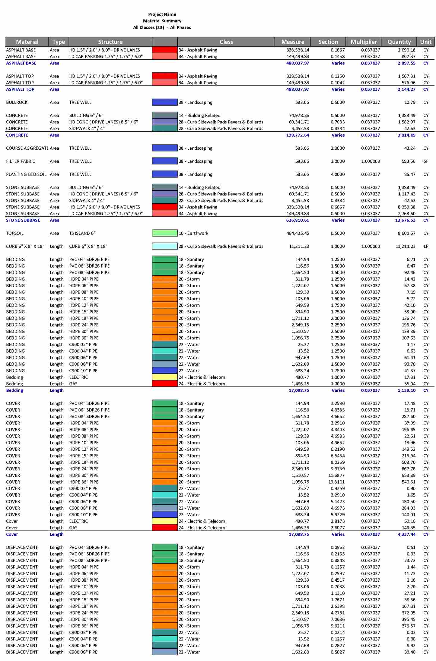
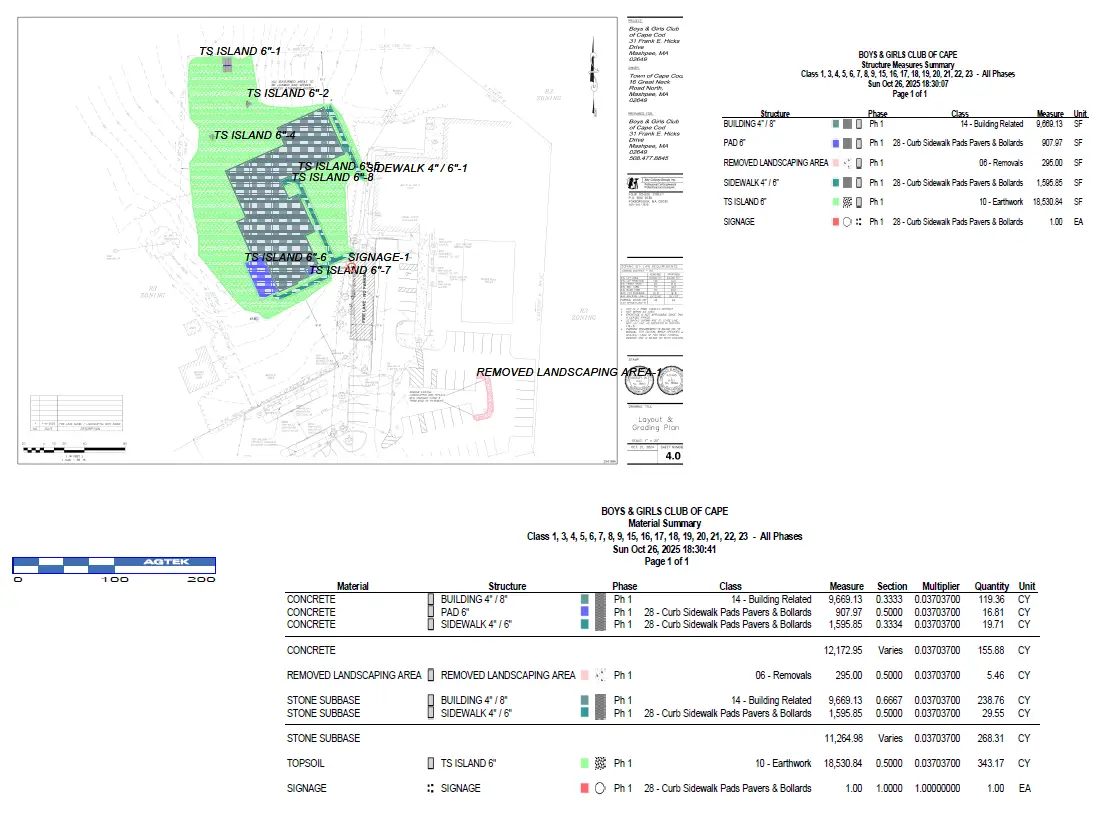
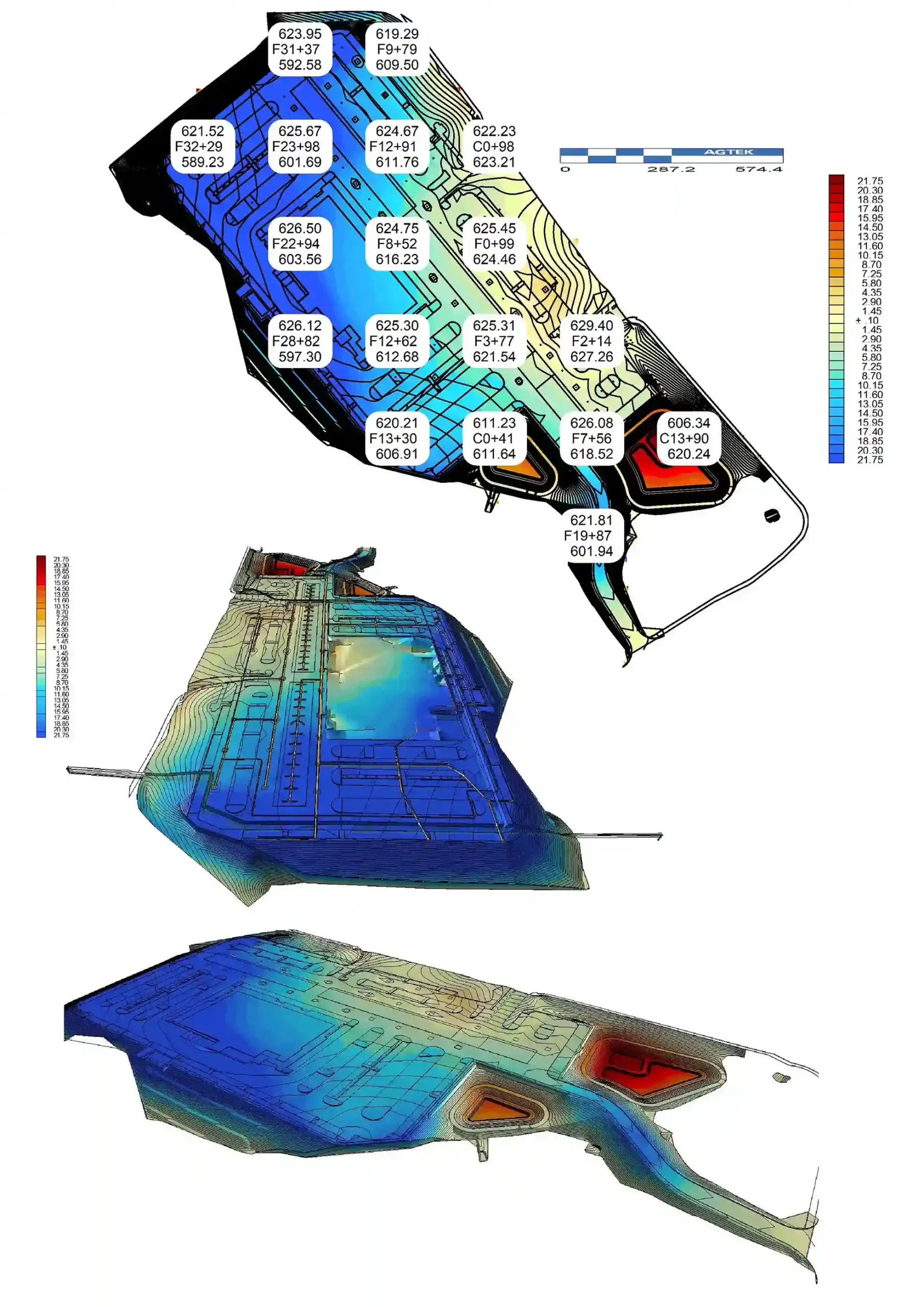
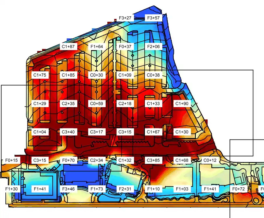
AGTEK Grading File: Detailed earthwork takeoff data, including existing and proposed ground surfaces, subgrades, stripping layers, boundaries, and 3D cut/fill volumes.
AGTEK Takeoff Reports: Detailed reports including full cut/fill volumes, utilities excavation, subgrades, surface breakdowns, depth brackets, structure measures and trench volumes.
We deliver precise earthwork takeoff services that help contractors and developers save time and avoid costly errors. From site clearing, excavation, and trenching to cut-and-fill calculations, topsoil stripping, and import/export quantities, every takeoff is prepared with industry-leading 3D softwares. Whether your project involves mass grading, utility trenches, rock excavation, or environmental controls, our clear, easy-to-read reports give you the insight to plan smarter and win more bids.


With Bluebeam, we can efficiently perform precise earthwork takeoffs by measuring cut/fill volumes, calculating material quantities and marking up plans directly on PDF.
We provide accurate earthwork and excavation takeoff services to support contractors, subcontractors, and developers during bidding and preconstruction. Our takeoffs are designed to reduce risk, improve quantity accuracy, and help you bid with confidence on earthwork-intensive projects.
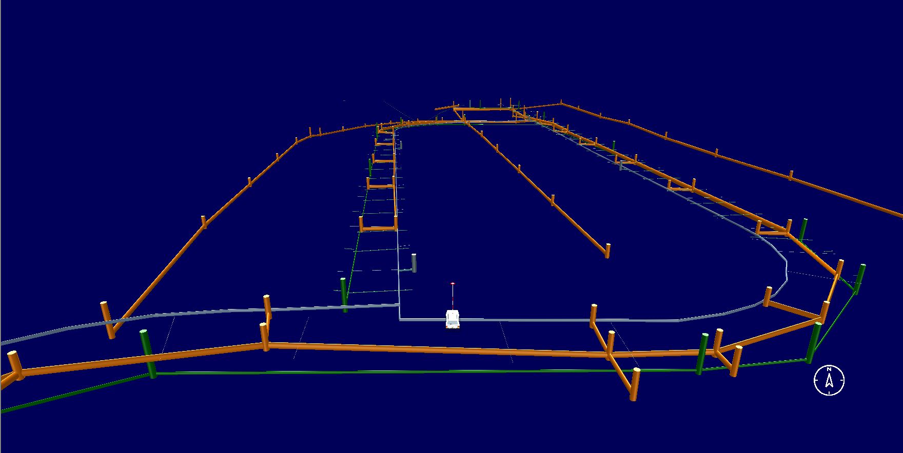
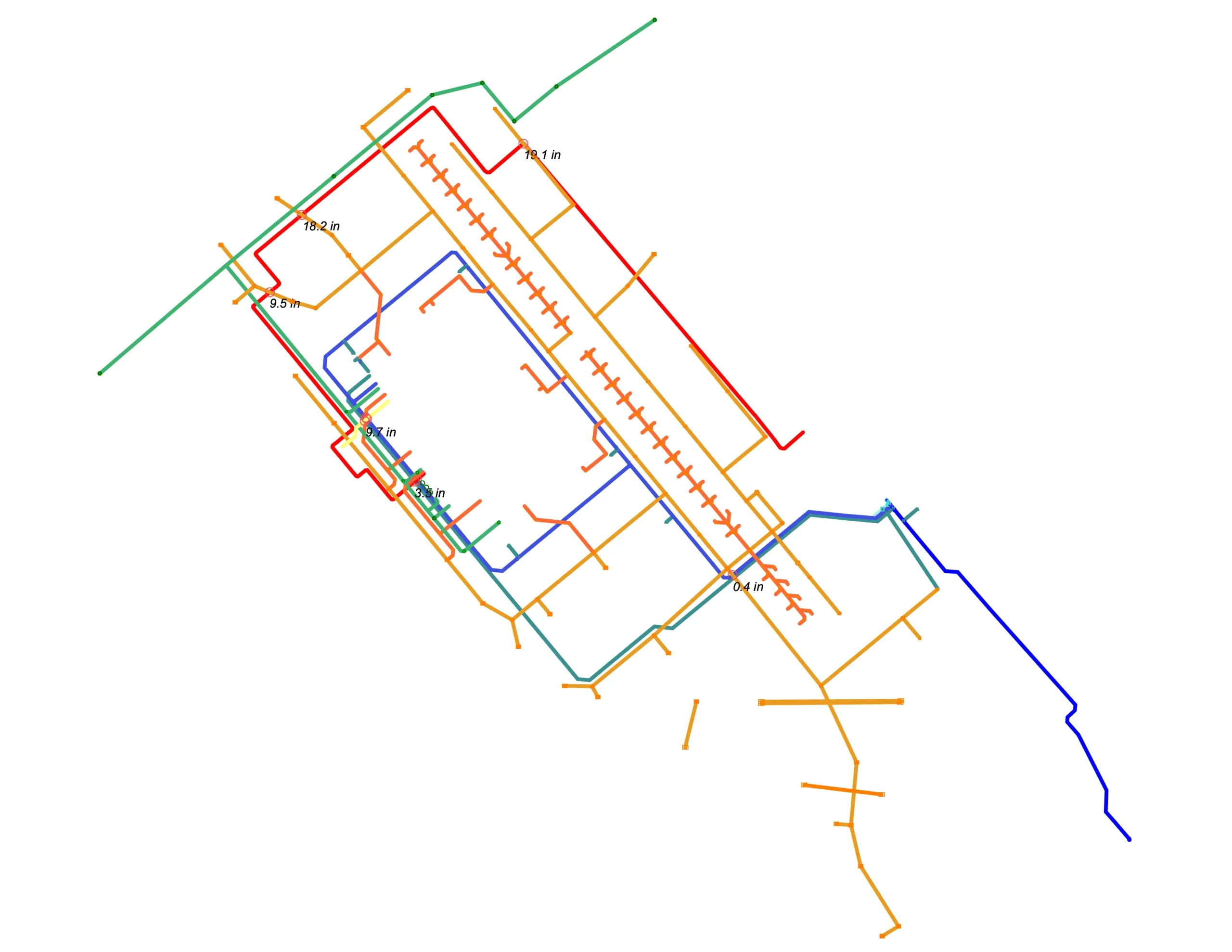
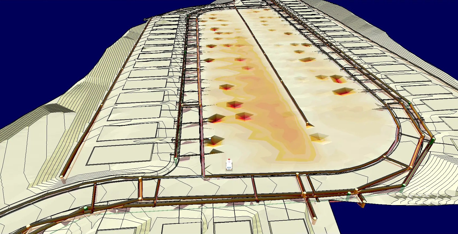
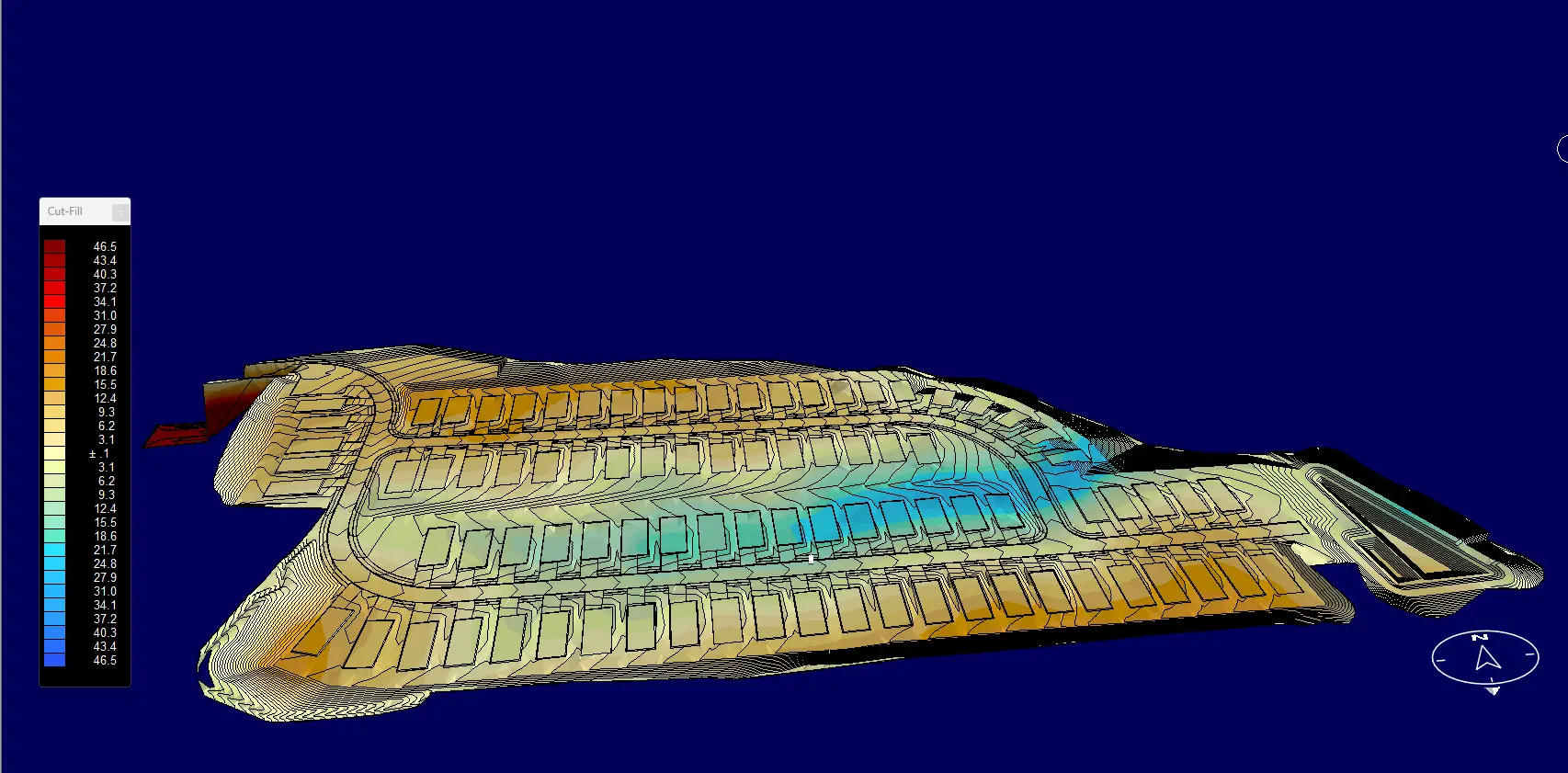
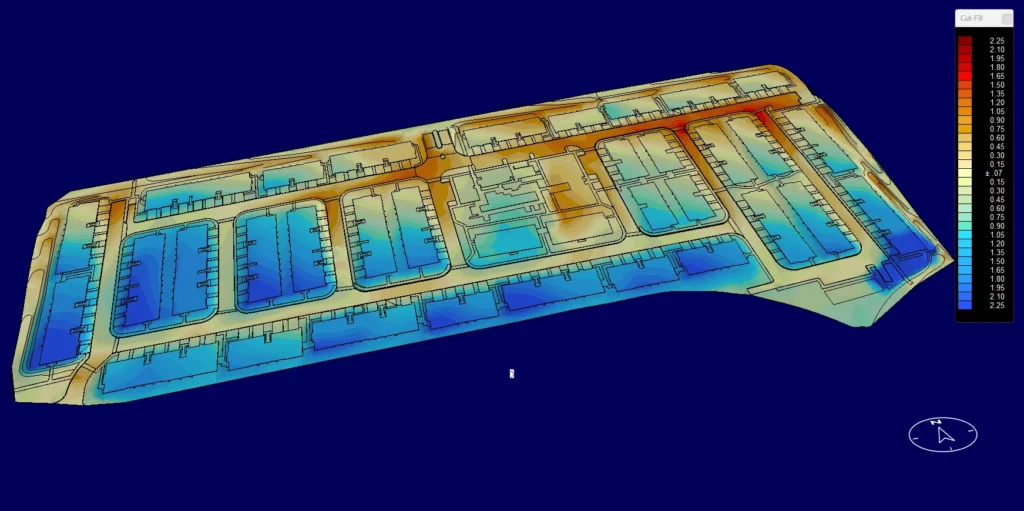
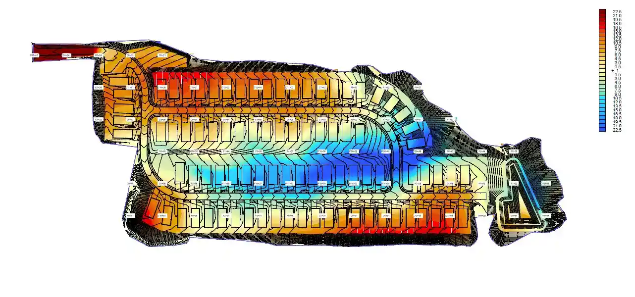
Using AGTEK 4D software, we prepare high-accuracy 3D dirt models, existing and proposed surface comparisons, and detailed cut-and-fill calculations. These models allow you to clearly visualize grading limits, balance earthwork quantities, and plan imports or exports before construction begins.
Our team also specializes in utility and trench takeoffs, including storm, sanitary, water, and other underground utilities. We develop precise trench quantities with clear depth, width, bedding, and backfill calculations, along with 3D utility and trench models for better coordination and pricing accuracy.
An earthwork takeoff is a detailed measurement of all excavation and fill quantities for a construction project. It includes calculating cut and fill volumes, site grading, and material quantities required for site preparation.
Outsourcing earthwork takeoffs can save time, reduce errors, and improve cost accuracy. By leveraging experienced professionals and digital tools, contractors can receive precise cut/fill volumes, material estimates, and grading analysis without diverting internal resources from other project tasks. This leads to faster project planning, better budgeting, and more informed construction decisions.
A 2D takeoff is based on traditional plan drawings in two dimensions (length and width). Estimators manually calculate cut and fill volumes using cross-sections, contour lines, and spot elevations from PDF or CAD drawings.
Pros: Lower cost, faster turnaround, suitable for smaller or less complex projects.
Cons: Limited accuracy, higher chance of human error, does not visualize terrain in 3D.
A 3D takeoff uses digital terrain modeling (DTM) software to create a three-dimensional model of the existing and proposed site surfaces. The software then calculates precise cut and fill volumes directly from the model.
Pros: Higher accuracy, better visualization, faster for large/complex sites, integrates well with machine control and GPS grading equipment.
Cons: Slightly higher cost, requires good-quality CAD or PDF files.
We require the project’s civil site plans, grading plans, and any geotechnical reports if available. CAD or PDF format are acceptable formats.
At Veracity Estimating, we use AGTEK, one of the most advanced and widely recognized earthwork takeoff software programs in the construction industry. AGTEK allows us to perform highly accurate calculations for cut, fill, and grading quantities, generate 3D models of your site, create color-coded maps, and produce detailed volume and material reports.
While we use precise digital methods and available geotechnical data, actual site conditions may vary. Our reports are intended as estimating tools only.
We import site plans, CAD, or PDF drawings into AGTEK, define existing and proposed grades, calculate cut and fill volumes, and generate detailed reports and 3D visualizations. This ensures precise and reliable earthwork estimates for your project.
We provide a full range of sitework and civil engineering services to support accurate planning and bidding.