GPS-enabled 3D machine control models

by VERACITY ESTIMATING

- 3D modeling, GPS modeling
- Expert 2D/3D Modeling
- 3D Dirt Work Models

We provide highly detailed GPS-enabled 3D machine control models that help contractors build with unmatched precision. Our models are fully compatible with major systems like Trimble, Topcon, Leica and others, ensuring your grading and excavation equipment performs exactly as designed — right the first time.

3D GPS Machine Control Models for Accurate Grading, Excavation and Sitework

Residential Machine Control Models

GPS Machine Control Modeling United States

Our Residential Machine Control Models are designed specifically for precision work on housing and subdivision projects. We transform your 2D grading and site plans into detailed 3D terrain files compatible with Trimble, Topcon, and Leica and all other major systems, allowing your equipment to perform exact cuts and fills without manual staking.

These models help achieve proper drainage, pad elevations, and driveway slopes with minimal effort in the field. By using accurate digital terrain data, contractors can complete residential grading faster, save on fuel and material costs, and deliver smooth, build-ready lots that meet engineering design standards.

Commercial Machine Control Models

GPS Machine Control Modeling Services

We provide highly accurate 3D Machine Control Models for excavators, dozers, and grading machines — fully compatible with leading platforms such as Trimble, Topcon, and Leica.

Our models are built using precise digital terrain data to ensure smooth grading operations, accurate cuts and fills, and reduced rework in the field. Each model is carefully validated for alignment with project design files and site benchmarks, ensuring seamless upload and use in your GPS-enabled equipment.

Whether it’s a site grading, roadwork, or large-scale earthmoving project, our machine control models help your operators work faster, smarter, and with maximum accuracy.

Heavy Highway Models

Dozer Machine Control Model

We specialize in delivering Heavy Highway 3D Models tailored for GPS-guided construction systems, including Trimble, Topcon, and Leica. Our models are developed with high precision to support roadway grading, paving, and drainage operations — ensuring smooth transitions, accurate cross-sections, and optimized material usage.

Each model is carefully structured to match project alignments, profiles, and design surfaces, allowing your machine operators to follow exact design intent directly in the field. By using our heavy highway models, contractors can achieve faster production, improved accuracy, and reduced rework across complex roadway and infrastructure projects.

Heavy Civil Models

GPS Machine Control 3D Modeling

Our Heavy Civil 3D Models are designed to support large-scale infrastructure and utility projects with precision and efficiency. We create accurate digital terrain models that integrate seamlessly with your GPS machine control systems.

From bridges, dams, and interchanges to large utility networks and grading operations, our models ensure every surface, alignment, and elevation is field-ready. With a strong focus on constructability and accuracy, we help civil contractors reduce downtime, improve production rates, and deliver projects on schedule — with confidence in every pass of the blade.

Clients We Serve

GPS Machine Control Modeling Services in United States
GPS Machine Control 3d Modeling Services

Supported File Formats for Major GPS Machine Control Systems

we provide GPS-enabled 3D machine control models compatible with all leading systems:

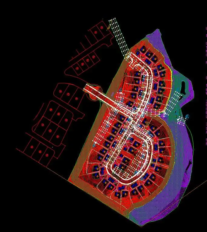
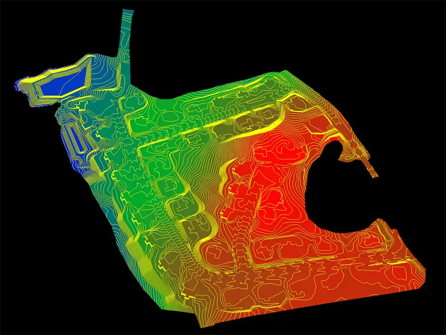
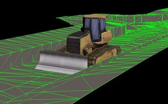
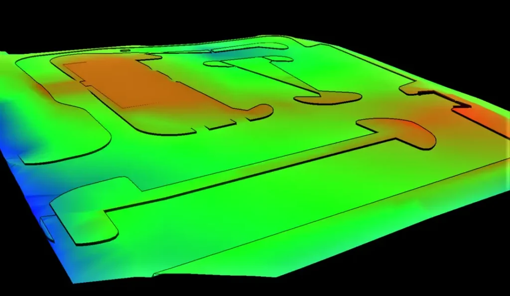
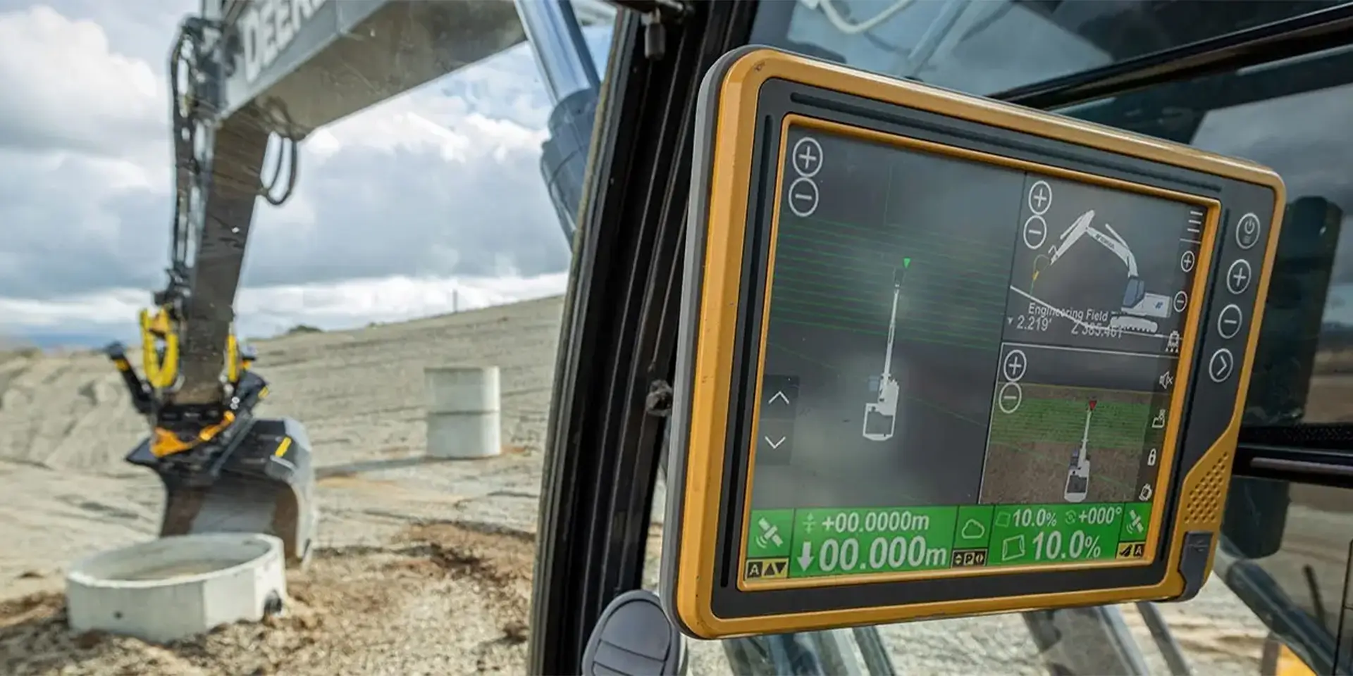
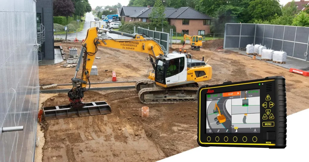
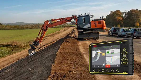
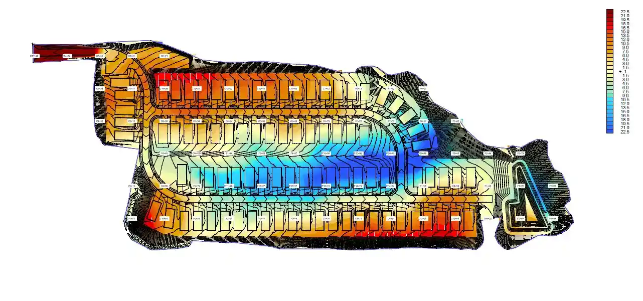
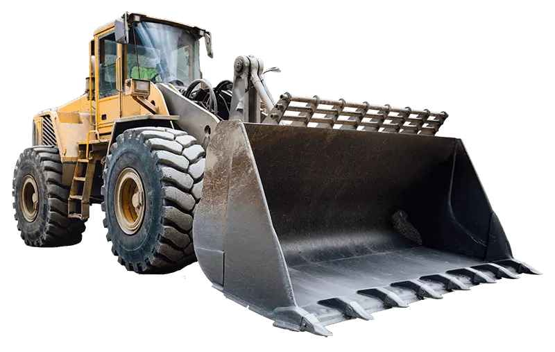
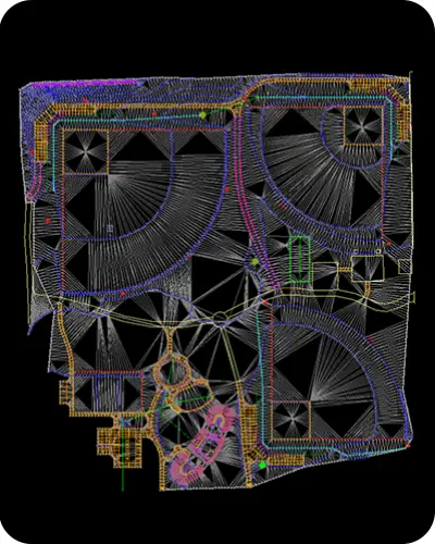
Machine control models

Our GPS Machine Control Models are designed for a wide range of heavy equipment, including excavators, dozers, graders, scrapers, backhoes, and skid steers. These models provide precise, GPS-calibrated guidance so each machine can automatically follow the design surfaces, slopes, and alignments, improving accuracy, reducing rework, and speeding up your earthwork projects.
earthwork takeoff services

Earthwork Takeoff - AGTEK

We specialize in providing comprehensive sitework takeoff services tailored to the needs of contractors, developers, and civil engineers. Our experienced team delivers precise quantity takeoffs and material breakdowns for every aspect of site development—from initial clearing to final landscaping.
demolition estimating services in USA

Why Choose Us for GPS Machine Control Modeling?

Highly Detailed & Field-Ready – Accurate contours, breaklines, subgrades, and daylight lines.
GPS-Calibrated Models – Align perfectly with your survey data.
Fast Turnaround – Most projects delivered in 2–4 business days.
Multi-Platform Expertise – Works with Trimble, Topcon, Leica, and Carlson.
Cost-Effective – Save thousands in rework and downtime.
Ongoing Support – We stay with you until your field team confirms accuracy.

Precision at Every Grade. When Accuracy Matters.

Transform your construction projects with 3D GPS machine control models that guide dozers, graders, and excavators with exact precision. Achieve flawless grading, excavation, and sitework, reduce rework, and optimize efficiency on every project.

Our Machine Control Modeling Process

Step 1: Receive Design Files

Send us your civil CAD files (DWG, DXF, PDF, or LandXML).


Step 2: Build the Digital Terrain Model (DTM)

We convert design drawings into a precise 3D model — including finished grade surfaces, subgrade, curb & gutter, and breaklines.


Step 3: GPS Calibration & Quality Control

Our technicians geo-reference the model using project benchmarks to ensure perfect fit with your GPS system.

4. Excavation

We model over-excavation for building pads or unsuitable soils as needed. Utility trench excavation (storm, sewer, water, etc.) is also staged and reported with backfill volumes.

5. Design Surface & Subgrades

We model the finished grade (FG) surface for parking lots, drives, sidewalks, and pads. Subgrade depths are applied per pavement and structural requirements for precise volume breakdowns.

Step 4: Delivery & Support

Receive ready-to-load files for Trimble (.ttm), Topcon (.tn3), or Leica systems — plus KML for Google Earth review.

Frequently Asked Questions

A GPS Machine Control Model is a digital 3D representation of your site used by grading and earthwork equipment. It guides machines like dozers, graders, and excavators to achieve exact elevations and slopes, reducing errors and rework.

Our models are compatible with Trimble, Topcon, Leica, and Carlson GPS-equipped machines. This includes dozers, graders, excavators, and other heavy equipment used for site development and road construction.

Our GPS machine control models are geo-referenced and field-tested for centimeter-level accuracy. They include finished grade surfaces, subgrades, breaklines, and daylight lines, ensuring your machines perform exactly as designed.

Turnaround time depends on project size, but most models are delivered within 3–5 business days. Larger or more complex sites may take slightly longer.

3D Machine Control Model is a digital representation of your site with surfaces, slopes, and break lines. A GPS Machine Control Model is a 3D model calibrated with GPS coordinates, allowing machines to automatically follow the design in real time on site.

What Our Clients Say

    James Hummel

    D&D Tri-Rivers Excavating

    We’ve partnered with Veracity Estimating for several projects now. Their machine control models are consistently accurate and easy to implement, streamlining our excavation processes.

      Kenny Wheeler

      Crosby Excavating

      The machine control models from Veracity Estimating have enhanced our grading precision, leading to smoother operations and reduced rework. Highly recommended.

        Billy Chambers

        Gilbert Excavating LLC

        Their machine control models have been instrumental in our projects. Their attention to detail and accuracy have made a noticeable difference in our grading outcomes.

          Samuel Carter

          Carter Grading & Excavation

          The Leica-compatible 3D models from Veracity Estimating have increased efficiency across all our heavy highway projects. Accurate cut-and-fill calculations saved both time and money on site.

            Emily Turner

            Turner Sitework Solutions

            Veracity Estimating provides highly reliable machine control models. From dozers to graders, every piece of equipment integrates seamlessly with our GPS systems, and the models are easy to read and implement in the field.

            Areas We Serve

            We deliver precise GPS Machine Control Modeling services across all 50 states, including high-volume markets such as California, Texas, New York, Florida, Pennsylvania, Illinois, Ohio, Georgia, North Carolina, Michigan, New Jersey, Virginia, Washington, Arizona, Massachusetts, Tennessee, Indiana, Missouri, Maryland, and Wisconsin.