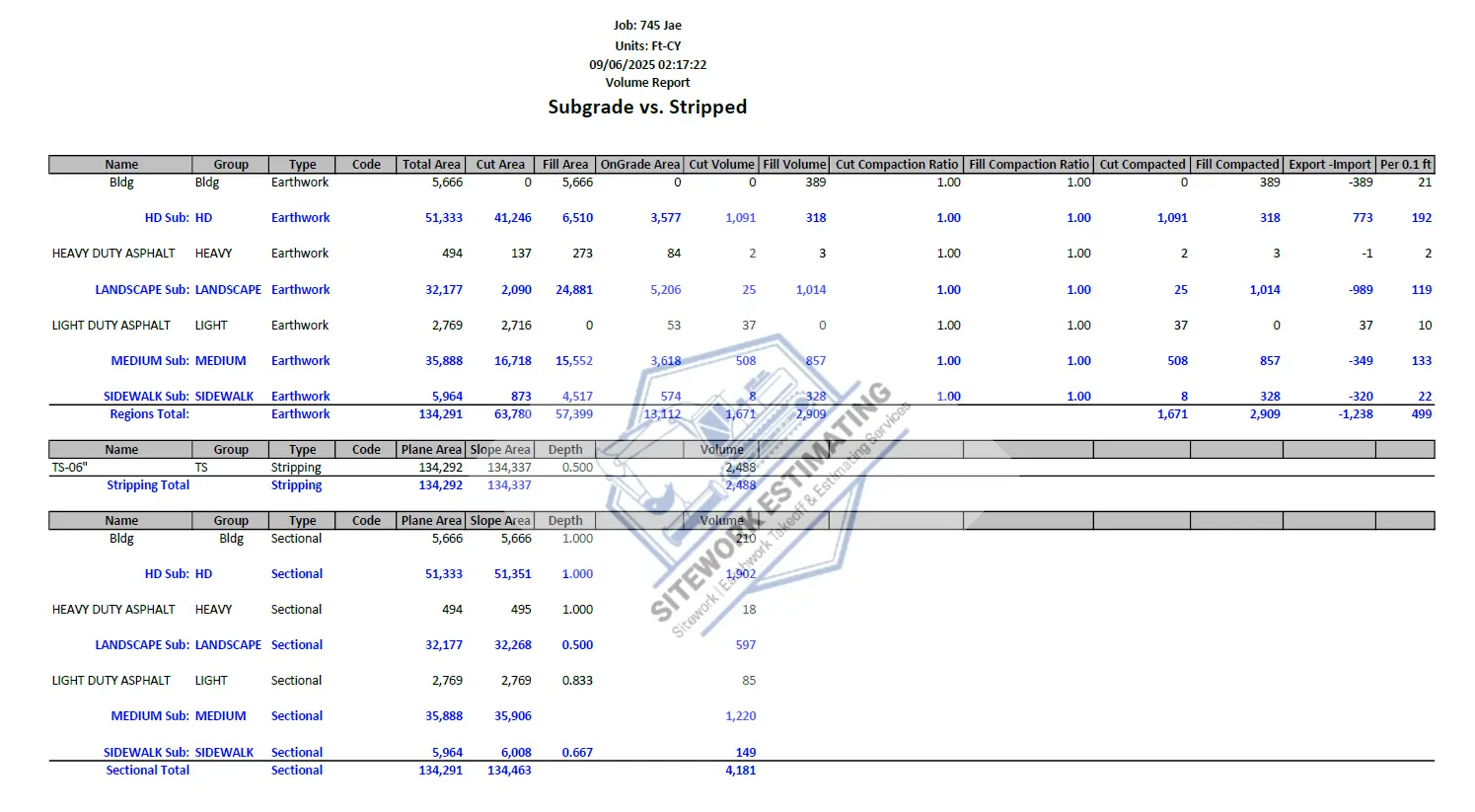
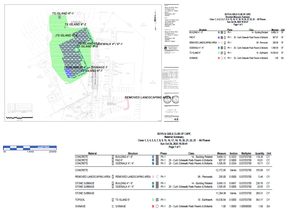
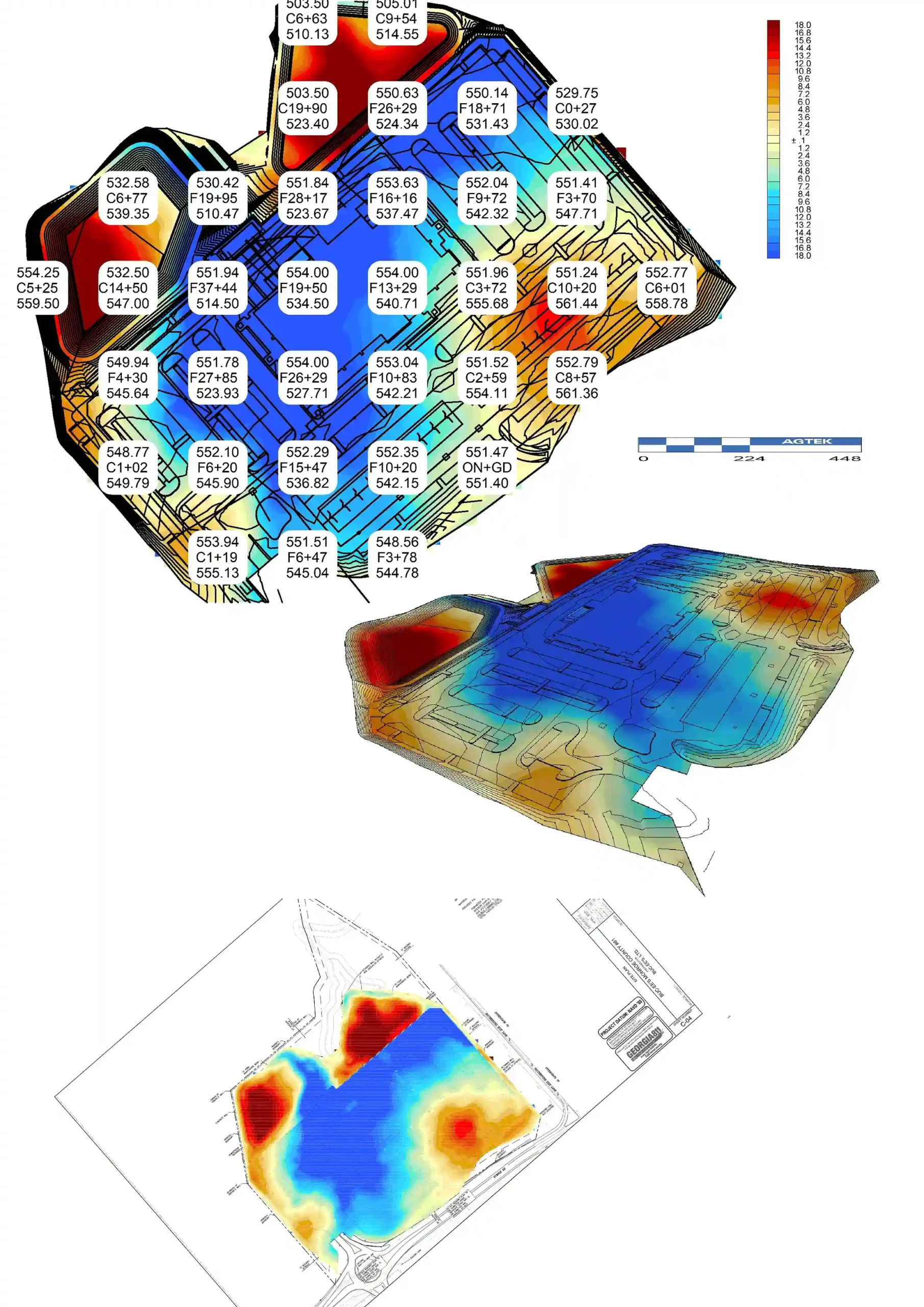
- All Required Detailed Reports:
Cut/Fill Volume Report, Depth Bracket Summary, Trench Volume Report, Building Excavation Footer Report, Structure Measures Summary, Material Summary Report, Structure Measures Report, Depth Bracket Report and Import/Export Summary.
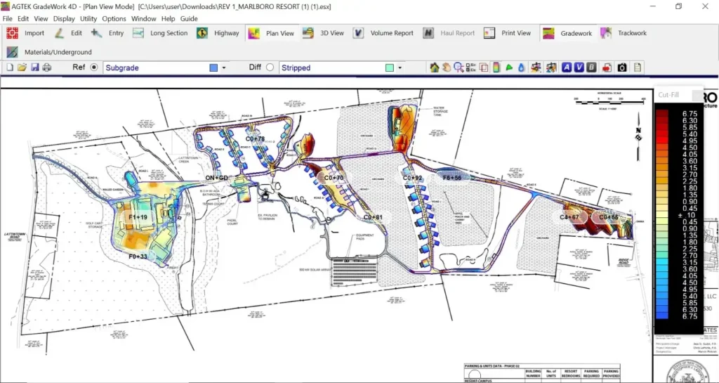
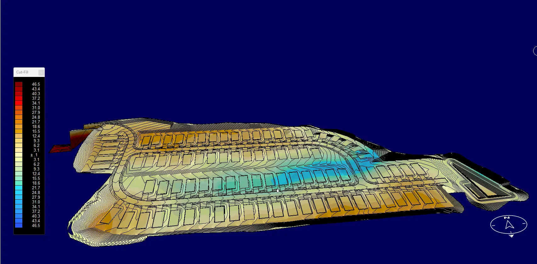
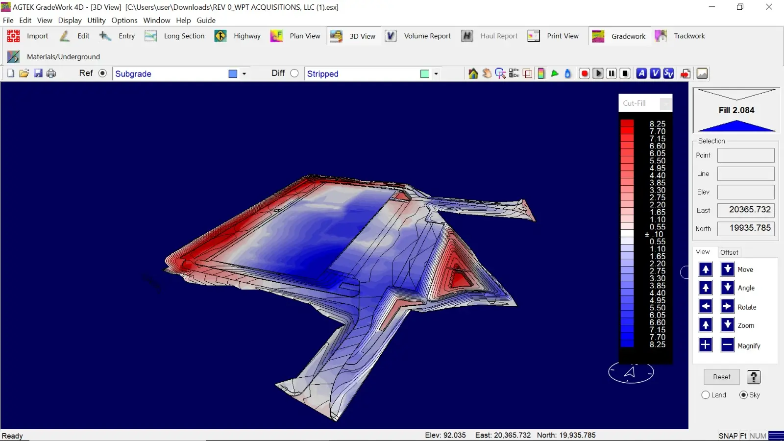
- 3D Dirt work Model and Map View:
Complete 3D Model and map view to support accurate earthwork takeoff, validation and clear communication of grading scope. This deliverable converts the project’s civil plans and survey data into a true 3D representation of the site, allowing stakeholders to visually understand grading intent and verify quantities with confidence.
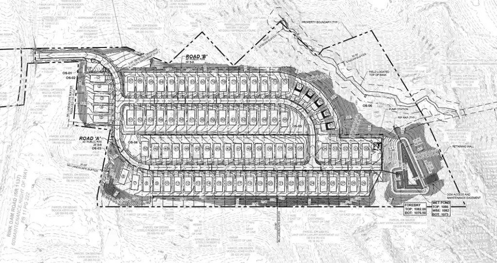
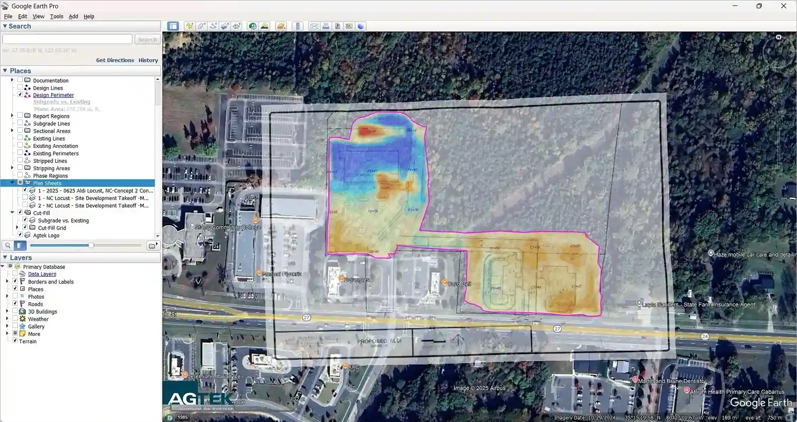
- Marked-up Color Coded Drawings:
Annotated drawings highlighting earthwork, civil work, and full sitework areas. These include cut/fill zones, grading, utility placements, and other key site elements, providing a clear visual reference to support the takeoff reports.
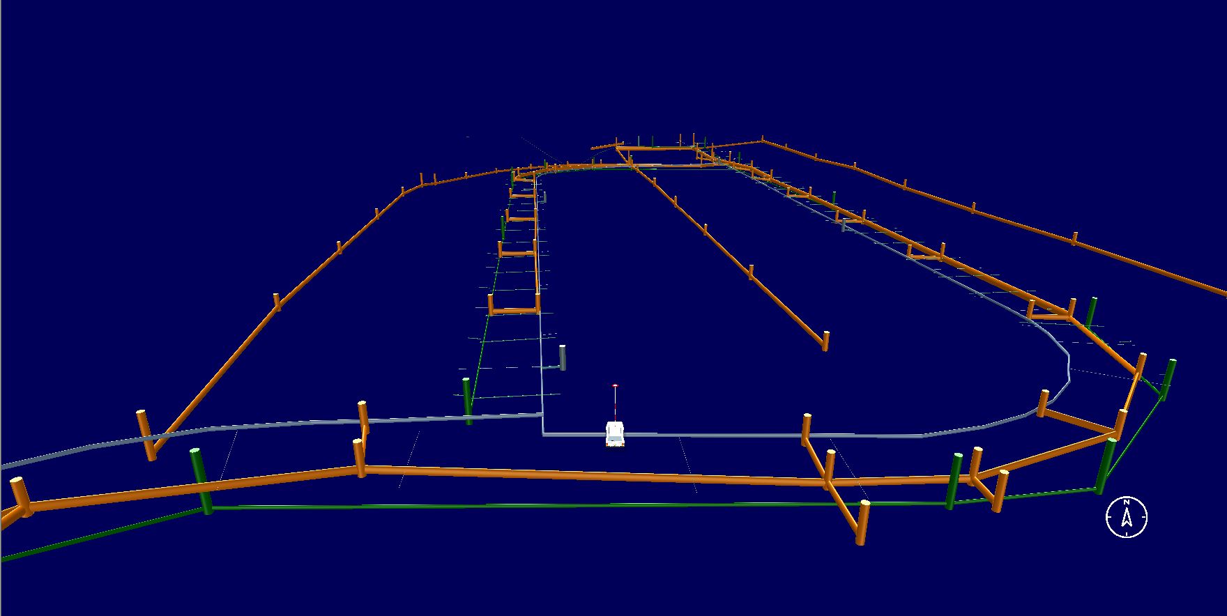
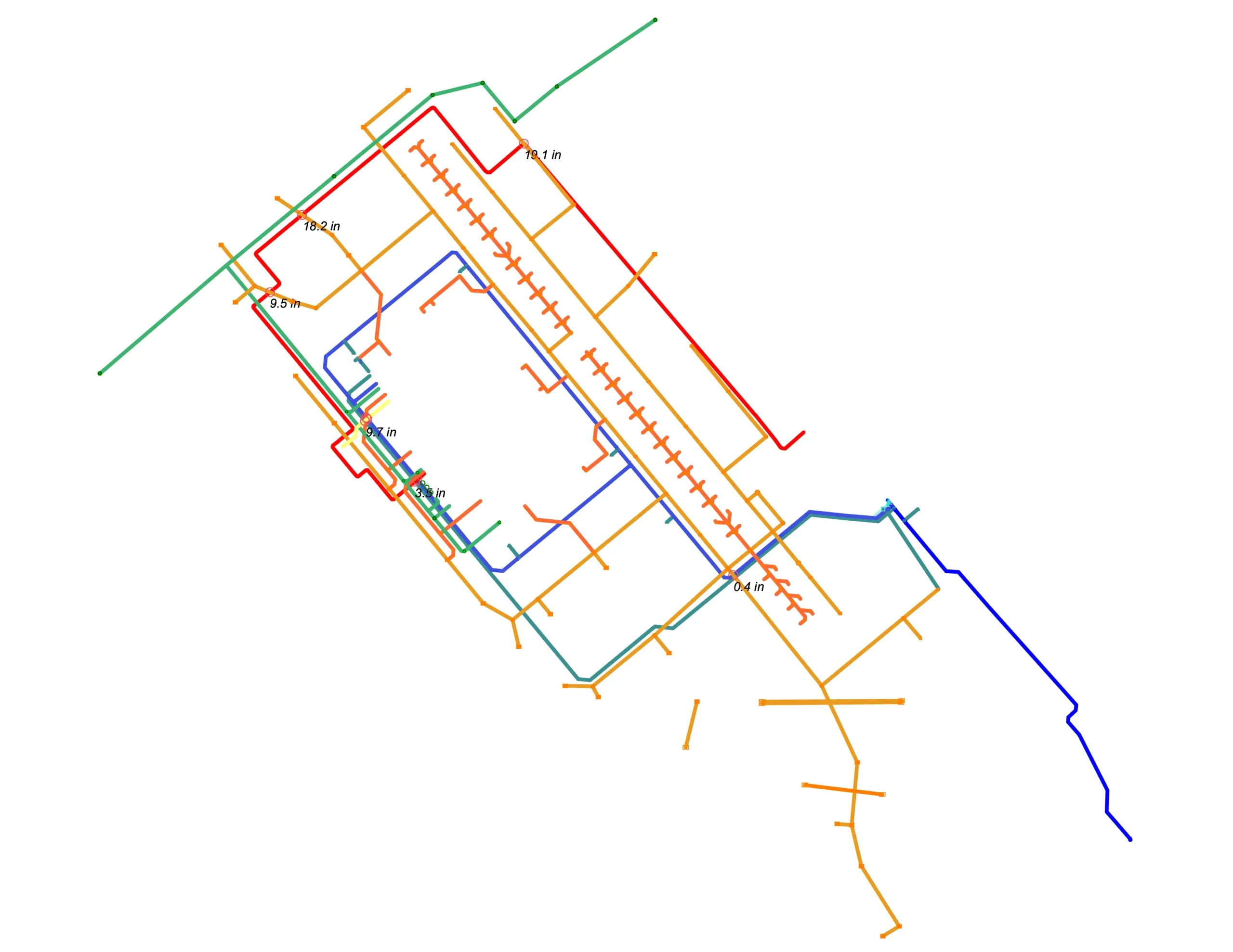
A full utility 3d model developed in AGTEK Grade Work 4D representing underground services in true 3D space (horizontal alignment and vertical profile). The model is built from plan/CAD linework and available utility elevations (invert/centerline/rim).
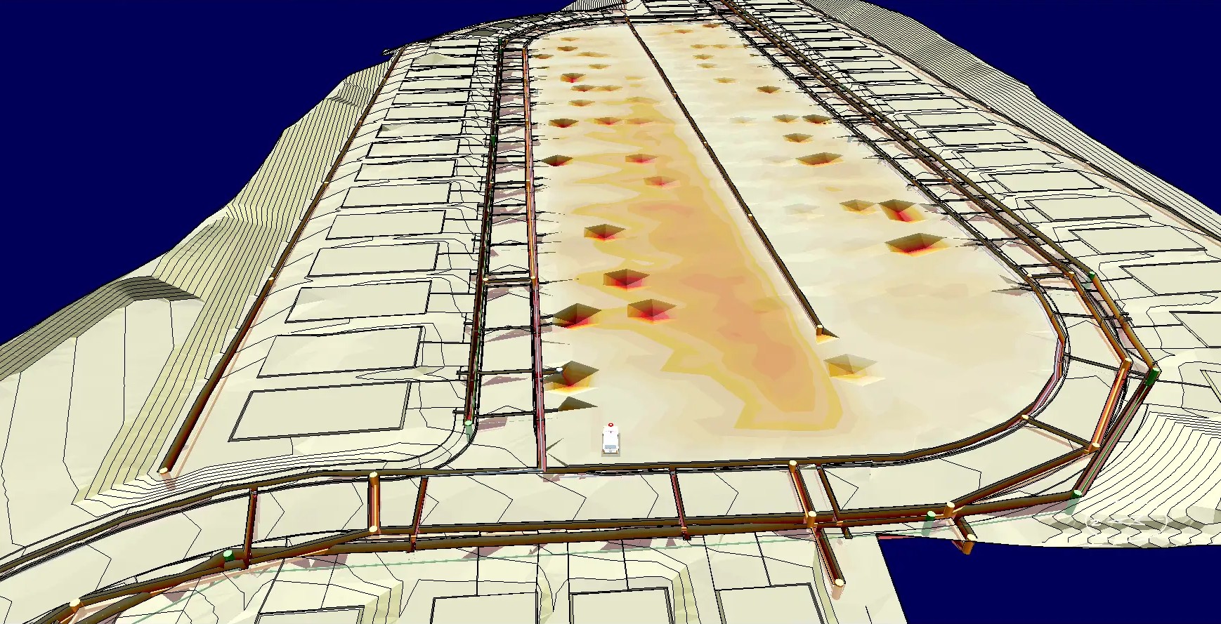
- Utility Conflict Identification:
A dedicated Utility Conflict Identification workflow is included to detect and document interferences (clashes/conflicts) between utilities, trenches, structures, and/or controlling surfaces.
- 3D Drive-Through of Site:
A dynamic 3D visualization of the project site created in AGTEK, showing terrain, grading, cut/fill volumes, and site features. This video provides an interactive, realistic perspective of the earthwork and full sitework.
For advanced verification and adjustments in AGTEK.
optional field review and general visualization.