Our civil engineering and drafting team specialize in site plan, grading & drainage plans, utility plans, . We turn complex site conditions into clear conceptual plans that give contractors, builders, realtors and developers exactly what they need to prepare and finish the site. Our drawings are simple, accurate, and easy to read — designed to remove uncertainty and keep construction moving.
We prepare permit-ready civil site plans for grading, drainage & utilities. Our work supports client up to point of permit submission; final stamping and permit approval are responsibility of client or engineer of record. We do not assume responsibility for permit approval.
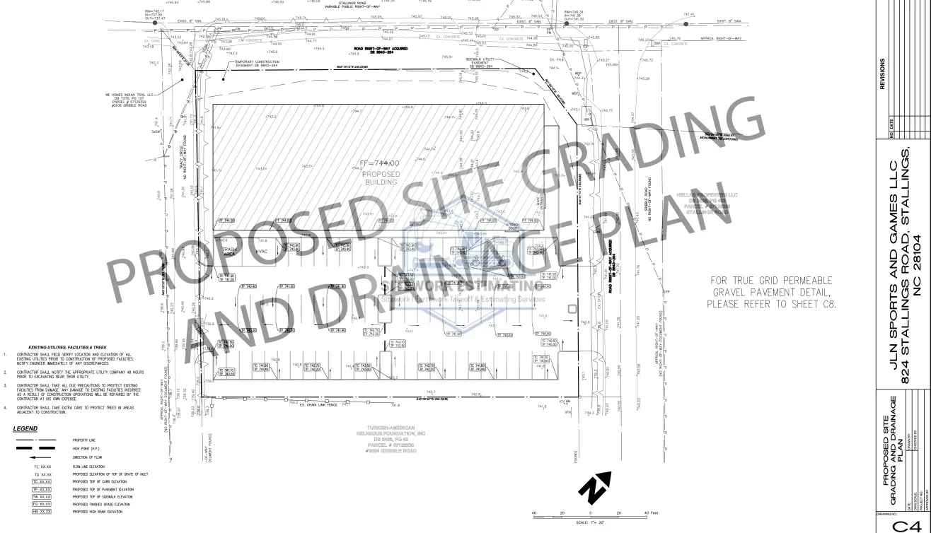
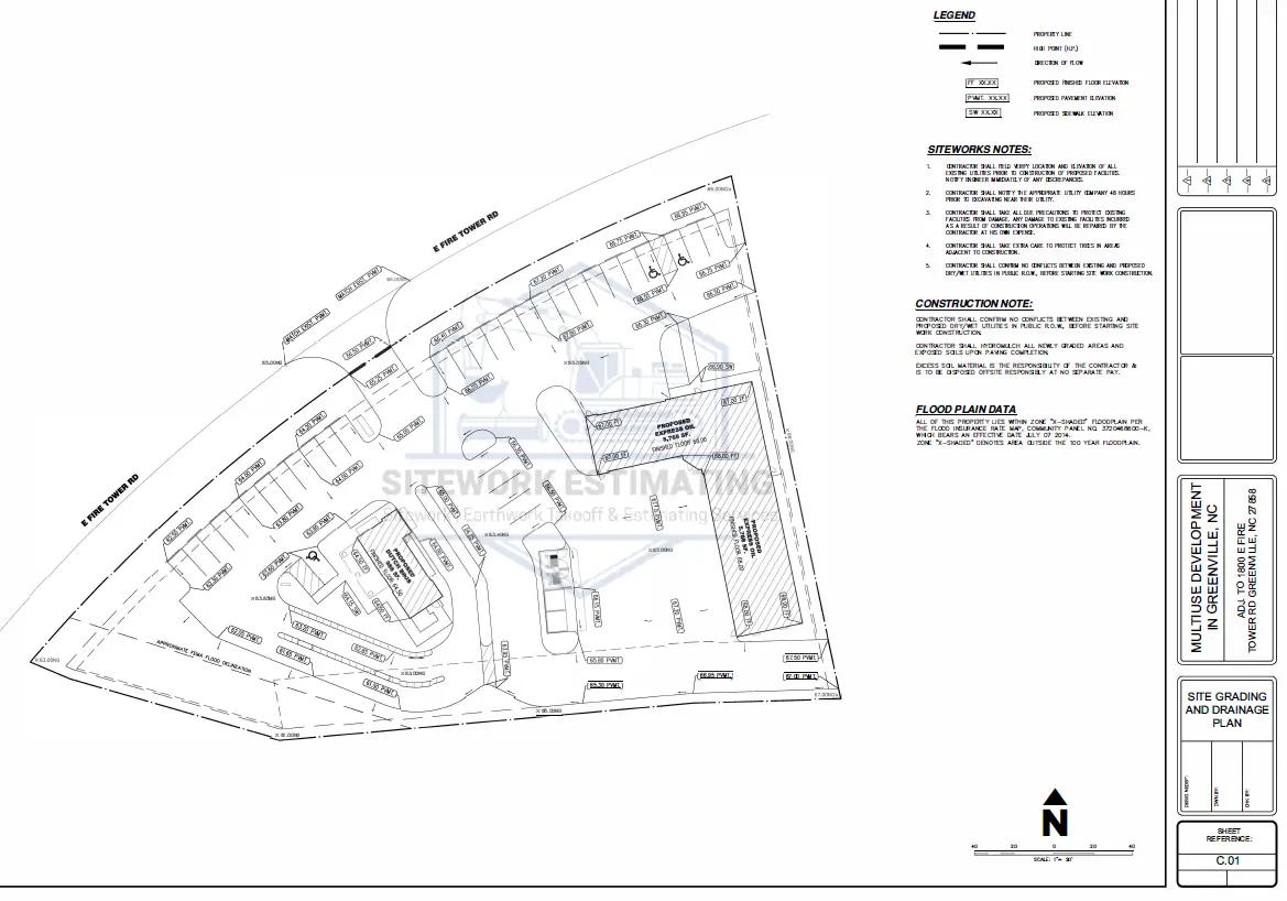
Detailed site plan designs for roads, driveways, paved areas, parking. We prepare site plan in accordance with applicable standards, including parking analysis, ADA compliance and building utilization.
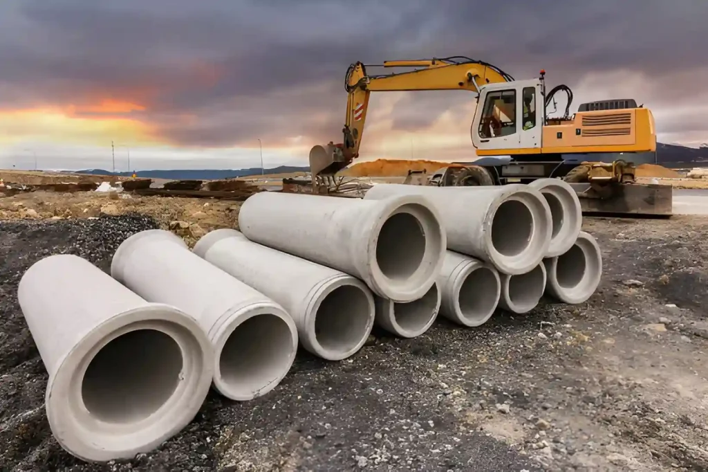
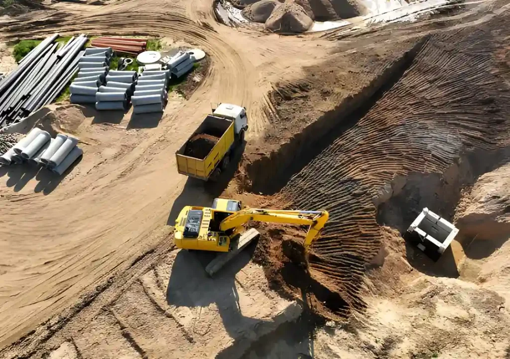
Draft design for underground utility infrastructure, including precise mapping and coordination of water, sewer and stormwater systems to ensure efficient and seamless construction.
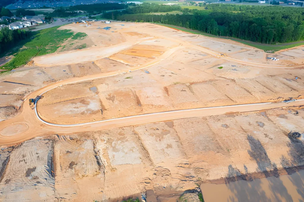
Concept grading designs illustrating precise cut and fill lines, slope directions and elevation changes to ensure accurate site preparation, proper drainage flow and balanced earthwork.
Clear instructions for safe and efficient removal of existing structures or site elements. These plans outline sequence, hazards, and disposal requirements.
Plans to manage runoff, prevent ponding, and ensure effective stormwater control.
Measures to prevent soil erosion and maintain site stability during construction.
Each package is customized for the project size and permit requirements so you get the right level of detail — no more, no less. Our drainage and grading plan packages typically include:
If a topography survey is not available, we can work using GIS data, though extra charges may apply. Similarly, if no proposed site plan or topography survey is provided, the client must provide a boundary or plat survey, which may also incur additional charges.
We deliver precise and easy-to-read civil design, grading, and drainage plans that help developers and contractors bring their projects to life efficiently. Our expert team ensures every plan is tailored to your site’s unique needs, providing clear guidance for earthwork, utilities, and stormwater management.
We provide advanced civil design services tailored for residential, commercial and land development projects across the United States. Backed by a skilled team of experienced civil engineers and architects, our firm delivers accurate, permit-ready site development plans that meet local authority and project requirements.
Our civil design solutions focus on grading plans, drainage design, underground utilities, and site optimization, ensuring constructability, cost efficiency, and regulatory compliance from concept through construction.
Dedicated Team of Licensed & Experienced Civil Engineers
Our in-house civil engineering team delivers accurate, code-compliant grading, drainage, and utility designs tailored to project requirements.
Proven Experience Across Multiple Project Types
Extensive experience in residential subdivisions, commercial developments, industrial sites, and large-scale land development projects throughout the United States.
Permit-Ready & Construction-Focused Civil Designs
All grading plans, utility layouts, and drainage designs are prepared to meet local, state, and municipal permitting standards, reducing approval delays and revisions.
Integrated Grading, Utility & Drainage Coordination
Seamless coordination between earthwork, stormwater, sanitary, and water utilities to eliminate conflicts and improve constructability.
Advanced Civil Design Tools & Industry Standards
We utilize modern civil engineering software and proven workflows to ensure precision, consistency, and efficient site optimization.
Fast Turnaround & Scalable Project Support
Reliable delivery timelines with the ability to scale resources for small sites or complex, multi-phase developments.
Cost-Efficient & Value-Driven Engineering Solutions
Designs optimized to reduce unnecessary earthwork, utility clashes, and construction costs.
Nationwide Civil Design Service Coverage
Supporting projects across all U.S. states while adapting designs to local AHJ requirements and regional codes.
Clear Communication & Engineering Support
Direct access to our civil engineering team for design clarifications and revisions.
We work with a broad range of public and private clients across the U.S. and Canada, including:
Using AutoCAD and Civil 3D, we ensure precise earthwork layouts for both small and large-scale projects.
AutoCAD – For detailed 2D drafting and construction-ready drawings.
ArcGIS Software – Mapping and geospatial analysis for site planning and design.
Civil 3D – Advanced grading, cut & fill analysis, and 3D site modeling.
Yes, our team includes certified civil design engineers with extensive experience in grading, drainage, utility, and site development plans. Each project is prepared and reviewed by qualified professionals to ensure accuracy, compliance with local codes, and practicality for contractors in the field.
If a topographic survey is unavailable, we can work with alternative data such as GIS maps, aerial imagery, or publicly available contour information. However, for precise construction-level plans, we recommend obtaining a professional survey to ensure accurate grading, drainage, and permitting compliance.
Absolutely. Our civil design engineers are experienced with local regulations across the U.S. and Canada. We create plans that align with municipal, county, and state requirements and can assist with plan revisions if needed for permit approval.
Our plans are highly detailed yet easy to read. They include cut and fill lines, spot elevations, surface flow directions, stormwater paths, utility locations, and typical construction cross-sections. Everything is designed to guide contractors accurately and minimize errors on-site.
Yes. We offer revisions to ensure the plans reflect updated site conditions or design changes. Our goal is to deliver construction-ready plans that contractors can rely on without confusion.
We provide plan sets in PDF format for review and field use, and editable CAD or GIS-compatible files if required. This ensures your team or contractors can easily integrate the plans into their workflow.
Turnaround depends on the project size and complexity. Typically, small to medium sites are completed within 4–7 working days, while larger, complex sites may take longer. We always provide a timeline when you request a quote.
To create accurate grading, drainage, and utility plans, we typically need the following:
Topographic survey (existing ground elevations, contours, and site features)
Site plans or civil drawings (CAD, PDF, or GIS files)
Property boundaries and easements
Geotechnical reports (soil types, topsoil thickness, rock depth — if available)
Utility maps (existing water, sewer, stormwater, and electrical lines)
Permit requirements or municipal standards (if applicable)
If any of these are not available, we can often work with alternative data sources, such as GIS, aerial imagery, or publicly available information. However, the more complete the documentation, the more precise and reliable the final civil plan design will be.
We proudly provide civil design, grading, and drainage services across the United States and Canada, including:
Northeast USA: Massachusetts, New York, New Jersey, Pennsylvania, Connecticut, Rhode Island, Vermont, New Hampshire, Maine
Midwest USA: Illinois, Ohio, Michigan, Indiana, Wisconsin, Minnesota, Missouri, Iowa, Kansas
South USA: Texas, Florida, Georgia, North Carolina, South Carolina, Virginia, Tennessee, Alabama, Louisiana, Kentucky, Mississippi, Arkansas
West USA: California, Washington, Oregon, Colorado, Nevada, Arizona, Utah, New Mexico, Idaho, Montana, Wyoming
Canada: Ontario, British Columbia, Alberta, Quebec
No matter the location, our team ensures compliance with local codes and regulations while delivering accurate, contractor-ready civil plans tailored to your project needs.
We provide a full range of sitework and civil engineering services to support accurate planning and bidding.